
Mt. Teide

I never really expected to visit the Canary Islands since I wasn't really aware of their status as cycling heaven. Thanks to Rich, a friend of mine, who told me about his trip to the Canaries that he did years ago. That's what really got the gears running. Throw in cheap accommodation + cheap flights, and you got a must-do trip!
As I mentioned in my first Gran Canaria article (Gran Canaria: Ayagaures), this was a spontaneous trip in every sense of the word. I had never been to the islands, let alone know much about them! However, after spending a good part of a day booking and planning the trip, I left the rest up for chance.
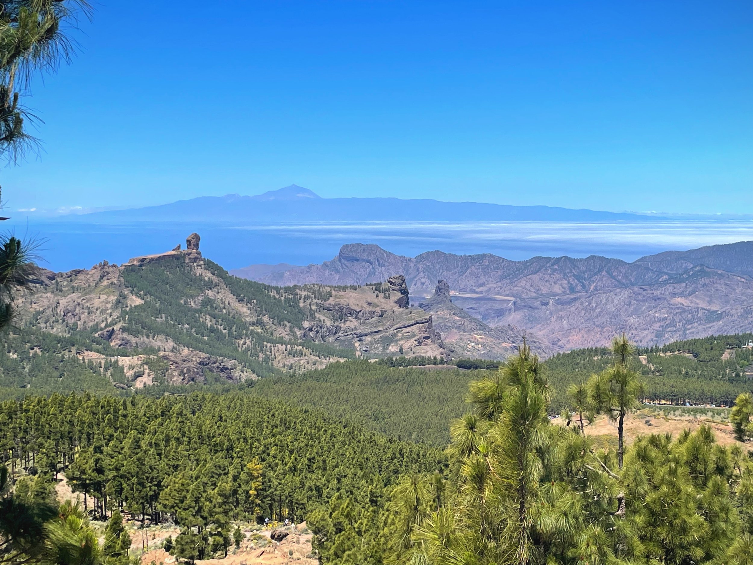
Mt. Teide seen from Pico on Gran Canaria
In previous articles, you can read more about the days I spent in Gran Canaria.
The last day was pretty short; I woke up packed and hit the road to catch the bus to the ferry on the western end of the island. The ferry ride to Tenerife was hands down the most magical ferry ride of my life so far. The view of the islands, visible ones at least, with the noon sunshine penetrating the deep blue waters of the Atlantic, was an experience worth every penny I had saved up.
As the ferry slowly sailed away from Gran Canaria, I saw the Pico towering on the island. Seeing it from that angle gives it a whole new perspective. The sheer size of that volcano is unfathomable until you take a step back or sail away in this case.
I left Gran Canaria both excited to visit the Queen of the Canarias and to miss the place I had just left.
A scene that can't be overlooked is how huge Mt. Teide, effectively Tenerife, truly is! As mentioned in previous Gran Canaria articles, these volcanic islands rise from the ocean floor about 6500ft below water level.
Mind-blowing!
Tenerife is the largest and most populated island of the archipelago. Just like its smaller neighbor, it is also home to many micro-climates all around the island, something that I experienced a few days after arriving.
More on that when the time comes!

The Ride:
Until a few days before getting to Tenerife, I didn't know what I had coming up. Then, the more I read about Mt.Teide, the more it sunk in... Apparently, Tenerife is the pros destination for high-altitude training! As a matter of fact, I ran into two international teams riding up the mountain on this ride.
The ride up to Mt. Teide is considered one of Europe's longest continuous climbs. There are 6 total ways to climb up to the summit. And since I chose to stay in Los Cristianos based on Rich's recommendations, that was my starting point.
Los Cristianos is a beach area in the southwest, meaning it'll get hotter compared to the other sides of the island. It is also the most famous way to start this epic bucket list ride.
I spent the few days prior to that carboloading for this ride, and I'm glad I did...
If you have ridden this or saw a video about it, you know that it's a single continuous climb with very few (if any) low enough grades to spin the legs while climbing.
The ride started with the steep inclines right off the bat!
No mercy.
Throughout 29 miles, I gained about 8300ft.
A number that I haven't hit before this trip!
I left Los Cristianos early enough to avoid the heat at lower elevations. Within 3 miles, I reached La Camella, with a gain of over 1200ft. Good warm-up...!
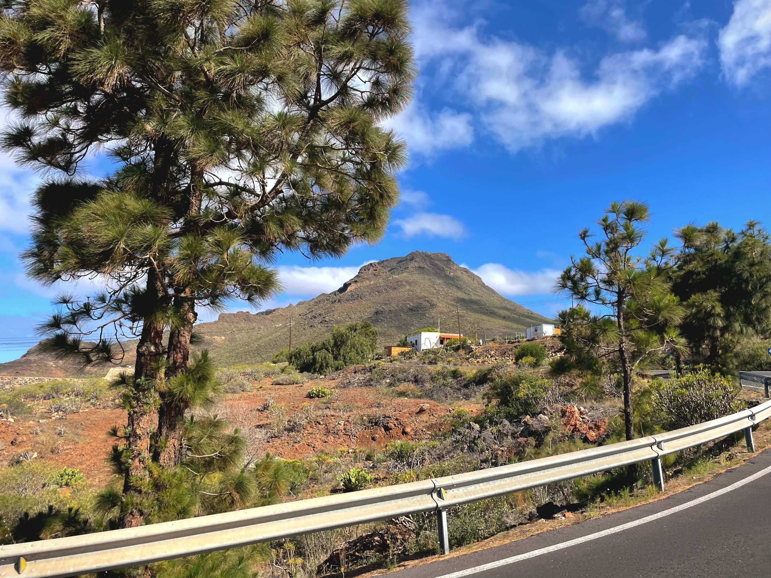
Past the small village is a section of the route with a long set of switchbacks climbing up the first of many steps all over this giant volcano.
10 miles into the climb, I reached 3400ft in elevation. I only realized how high I was when I could barely see the starting point and the mountain next to Los Cristianos like a tiny hill off the coastline. However, I still had over 5000ft more to climb, and the peak hadn't revealed itself. It's just hard to see a peak so tall when you climb up the side of the mountain.
Over those starting miles, I saw many other cyclists climbing and deciding, both acknowledging the epicness of this ride. Lots of thumbs up, words of encouragement, and even from locals sitting at their porches facing the main road. Rich did emphasize that there were little to no flat points, and I thought that sure was a hyperbole.
But it wasn't.

I knew I was getting up there since Pine trees were showing up with every foot I gained (or by looking at my wahoo profile...!). By mile 14, I reached one of the few rest stops, Vilaflor de Chasna, at 4600ft. I had already been thinking about what to eat since I started this ride!
I tend not to eat as soon as I wake up and wait until I'm a few hours into a long ride. That just works for me somehow. When in the Canary Islands, you get Papas arrugadas with lots of Mojo.
I made this a quick stop since I didn't want my legs to cool off; after all, I still had more than 3500ft to climb!
Just past the village was a viewpoint of the whole eastern side of the mountain and one of Tenerife's oldest and biggest Pine trees, Pino Gordo, a few meters in diameter. I ran into two older ladies from Germany touring around the islands in their VW bus. They were the De Facto cheerers for all cyclists climbing up that day.
They whipped out their camping chairs and sat by the side of the road, cheering cyclists as they climbed up. This is also common across mainland Spain especially in and around smaller villages.

Los Cristianos in the far distance straight ahead

At 5000ft, I found myself under a canopy of ancient pine on the southern side of the crater, where I stopped to check out the giants up close. I think the largest collection of giant pine I've ever seen was in Tenerife. The bark seemed much thicker than its counterpart in Eastern Oregon or even across the ocean in Gran Canaria. Apparently, it's due to the fiery nature of the volcanic island.
This got me thinking about La Palma, the most active volcano in the archipelago, and whether the bark would be even thicker there just before I continued up the road, the German ladies passed by again, giving thumbs up by the dozen.
The ride by the numbers when I got to the saddle part of the route was 21 miles, 7257ft of gain, 0 ft of descent, and a total of 3 hours.

The view from that height looking over the southwestern side of the island was pure magic, right out of a Nat Geo documentary or something. Across the horizon, the clouds reached some boundary in the stratosphere, forming a straight line. Only the peaks of the western islands were above the clouds. Just before leaving the viewpoint, the German ladies made the third cameo, but this time they stopped and chatted for a second. Again, they were blown away by the number of cyclists.
After a long Teide(ous) climb, I finally hit my first decent of the day. I descended alongside the western edge of the caldera and eventually made my way around it. The road curves right, and then there it was, the peak of Mt. Teide, revealed itself for the first time on this ride!


The Mt. Teide basin sits at 6700ft, with a massive lava flow welcoming you to the basin. The area looks straight out of a sci-fi dystopian arid planet, with the Peak of Mt. Teide rising over like the eye of Sauron, although less ominous and more mystical. The climb isn't over just quite yet. I still have to cross the basin past the middle point to Mirador El Tabonal Negro, the highest point on the route and turn-around juncture as well.
As is the case with many of the climbs I've done, the last part is always the hardest! Weak legs, running out of climbing juice, and let's not forget the elevation. The air was thin at +7000ft, as you could imagine. This was also the longest continuous climb I've ever done. I kind of burnt a few matches, even with an average effort.
Pushing through at elevation, I noticed a familiar VW bus waiting on the side of the road. There they were for the very last time along the climb, the two German ladies hearing the few cyclists they cheered along the climb! I reached the summit alongside a few other cyclists from the UK.
With that, I checked off a bucket list ride I didn't know I needed to do! The longest climb in Europe is officially in the books.

Now the best part hasn't even come quite yet. All that climbing meant I had roughly 8000ft of descent ahead of me. As you can imagine, this was a one-of-a-kind experience. I started descending as soon as I went over the saddle by the entrance to the national park. From there, I tracked back down to Vilaflor de Chasna, and instead of heading back the same way out, I went directly south, elongating the descent even further.
The descent truly felt like it was non-stop. In fact, I reached a village and said, "I bet I only have a little bit of a decent left.
I was wrong, and I'm glad that I was!

When I got closer to the edge of the village towards the viewpoint, I saw what I had left, which was quite a lot! I could barely see any details in Los Cristianos, let alone the mountain next to it. I stopped for a quick minute to shake off my hands that went numb from tucking in for so long and texted Rich, "This was a very long descent. Every time I think I reached lower elevation, another huge dip was just around the corner!"
This went for a while, over an hour and a half, actually.
Alas, I knew that this beautiful descent was sadly ending when I passed through the town of La Camella, where I turned onto the main climb about 5 hours earlier in the day, thus completing a full circle. With that, I only had a few miles to savor every last drop of elevation before reaching Los Cristianos.
This was a ride to remember for sure. Again, thanks to Rich for the insight and encouragement.