

Tse’tse’ede circumnavigation

After two years of multiple trips through the Alvord desert on the east side of Tse'tse'ede (aka Steens mountain) and multiple incomplete attempts to ride up the gentle, prolonged west slope from Frenchglen, Oregon, we return to the mountain in 2022 with aspirations of completing explorations.
A circumnavigation is one item on the agenda. On main roads, this would be quite a long trip, with too much heavy metal (cars & pickups) for our liking. However, there are a number of dotted roads on maps that suggest potential back-door routes. Unfortunately, my experience is that many back roads end up crossing private land, and there will be an unwelcoming gate with a hostile sign to greet the explorer.
Thankfully, an overlay map on GaiaGPS reveals landowners and boundaries. I find that one large segment of back roads/paths is only passable over the million acres of Roaring Springs ranch. I researched their website and corresponded with ranch manager Stacy. Although I did not obtain permission to cross the ranch where I requested, Stacy suggested we explore a flatter section of their ranch, and we take him up on the offer. We plan a 4-day clockwise route around Tse’tse’ede, including the Catlow valley through Roaring Springs ranch.

The base camp lies on the border of the Alvord desert playa. Our tent is on a low rise, just off the mud flats tucked into the sagebrush, opening toward tomorrow’s sunrise. A coyote wanders through camp behind us, but we sense it, turn, and stare as it takes its time walking through camp.
It takes a bit of time to review everything needed for a 4-day trip, pack it into front, frame, seat packs, and a backpack and then dispense with non-essential items. Tools and emergency parts are essential, though, on this self-supported desert trip. There are no bicycle parts available in the region. Carrying enough water and planning where to find more takes forethought. We leave a stash of water here for our return.

Day 1
Route:
After a hearty breakfast, we embark north across the playa before any wind picks up. The playa is part of the East Alvord Wilderness study area, but vehicles are allowed to travel anywhere on the playa. At the north drainage, sagebrush returns, and probing leads to a gravel road through Mickey Basin. We bypass Mickey Hot Springs this time, a very small but delightfully warm spring to warm your feet in (on a rivulet away from the main cauldron).
Sulfur Spring-Mickey Road crosses federal BLM land where aside from cattle, the main signs of life are wild mustangs and a curlew. We close every gate behind us that we open. We pass through a final gate, reaching the main gravel “highway”, Folly Farm Road. On the outer side, a sign reads “No Trespassing.” I guess the rancher didn’t feel like cyclists would be approaching from the desert side and, fortunately, left the inner gates unlabeled. Always interesting how the final kilometer on private land can block access to public land while the landowner enjoys private access to public land.


The barbed wire fence didn’t mean much to the cattle either as I watched a full-grown steer jump over the barbed wire fence with his front legs and drag his underside over the wire. I wonder how that feels. Obviously, cattle ignore signs as well. Fences seem like Ranch Management Theater.
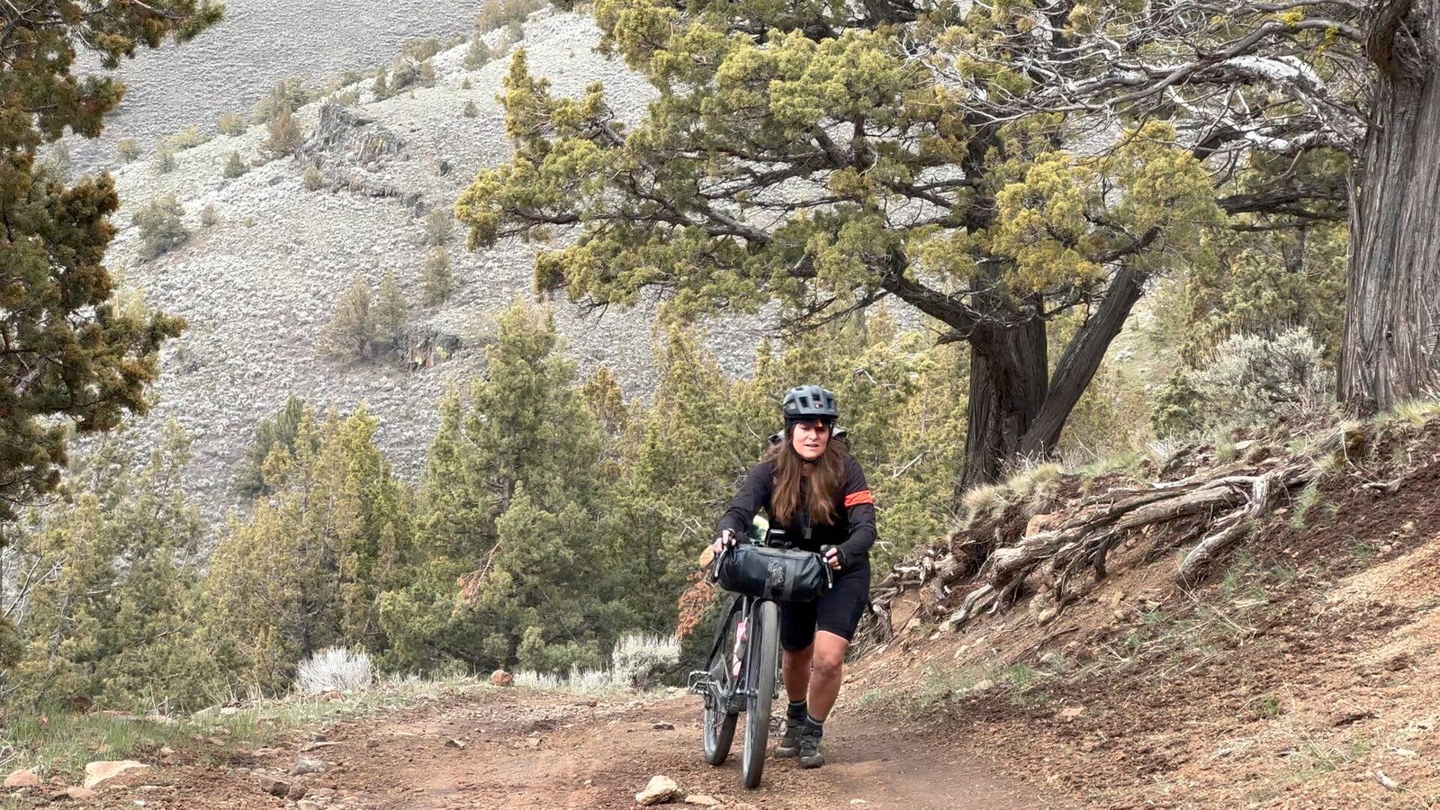
We leave sagebrush country, climbing steeply up Stonehouse Creek road. Amy fills her bottle with water from the creek, the first water we have seen all day. We’ve learned how to visually ignore the round brownies scattered about, though we do treat the water with UV light.
Further up the incline, we pause to rest for a few moments, a dog appears, and around the corner, a pickup truck and tent are parked off the road under trees. Waving, John wanders over, greeting us with two beers. We don’t happen to drink alcohol, but we really appreciate his generosity. He suggests that we get our water further up the creek, though, as he found a dead cow in the creek there. Amy empties her water bottle.


Back in the saddle, we meet the only other cyclists we will see on this journey coming downhill. Chatting for a few moments as the sun descends below the rim, leaving the canyon in shade, John Harvey and his friend are attempting Oregon’s Big Country loop, a somewhat popular multi-way loop in the region.
As the road diverges from the creek, we fill our water bottles and water bladder at this upstream location, presumably near a spring. Dusk is settling, we are tired, and it is difficult to find a level place. I wander across a ridge, finding a slightly tilted area beneath an ancient juniper on an otherwise steep slope composed of loose rectangular rock. Owls hoot us to sleep.
Day 2
Route:
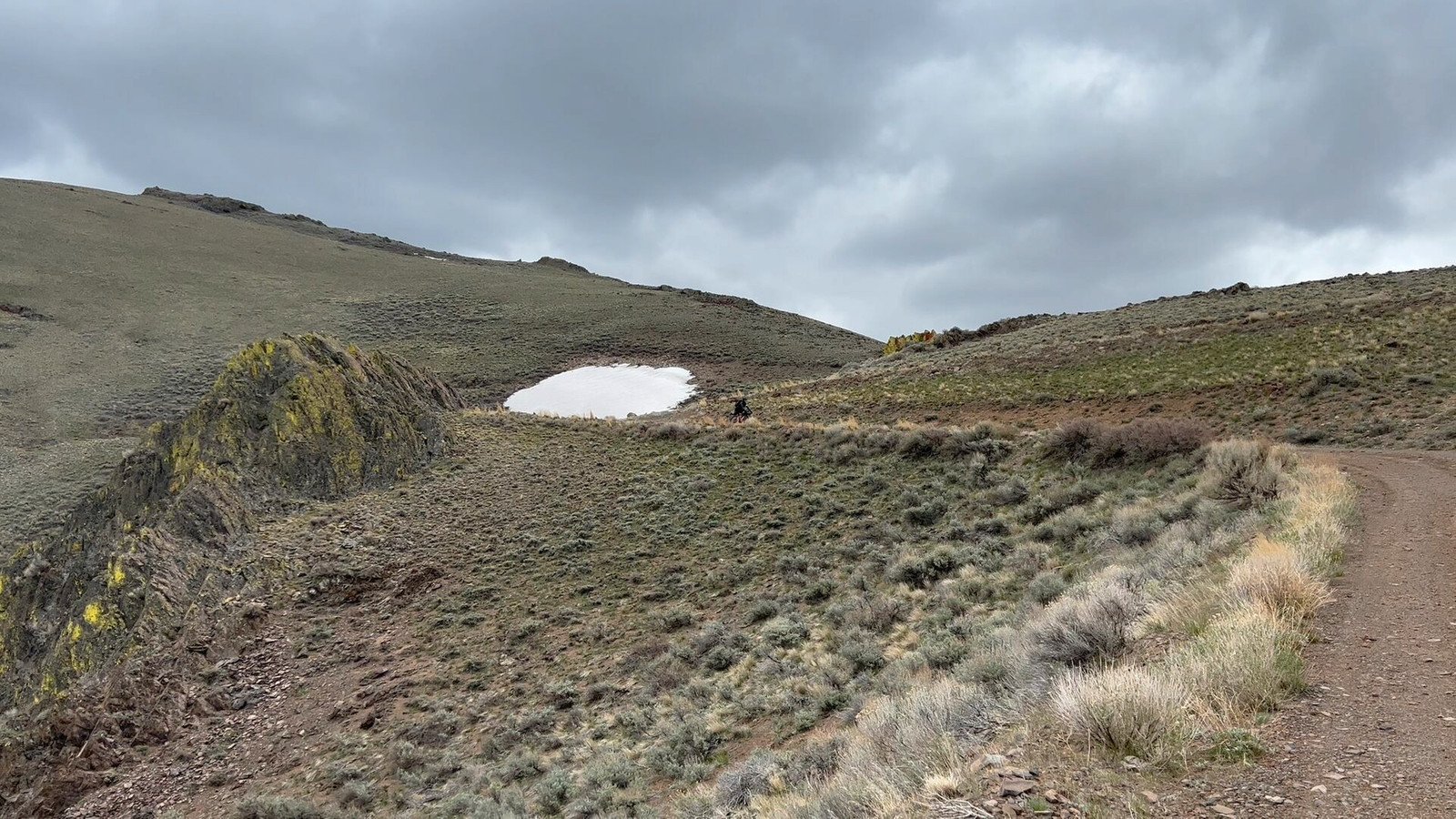
We cross Tse’tse’ede’s north ridge on day 2, encountering a few patches of snow, nothing that we can’t hike through. Turning northwest at Paddle Meadows feels a long way from anywhere. This is the moist side of the mountain, and wildflowers pop along the double track. The tracks are even mushy along Deep Creek.
Descending the northwest slope, quite likely over Paiute encampments,* the direct road is blocked by a No Trespassing sign. I edit our route on the go down Kiger Spur road to Smyth Creek Road. David H. Wilson Jr’s Northern Paiutes of the Malheur describe this area as Chief Egan’s homeland.

Circumventing the private route, we enter an overgrazed and nearly barren pasture where most of the cattle trot off of the road ahead of us, and there are a lot of cattle! We converge on Happy Valley road into Diamond.
Starting down over the Malheur escarpment, the wind picks up such that when Amy rounds a corner, her bike blows over. I’m guessing the winds funneling around the bend were above 50 miles an hour. When she picks up the bike, it flaps in the wind like a flag. We hike, pushing our bikes downhill on the road. We are now crossing some of Roaring Springs Ranch.
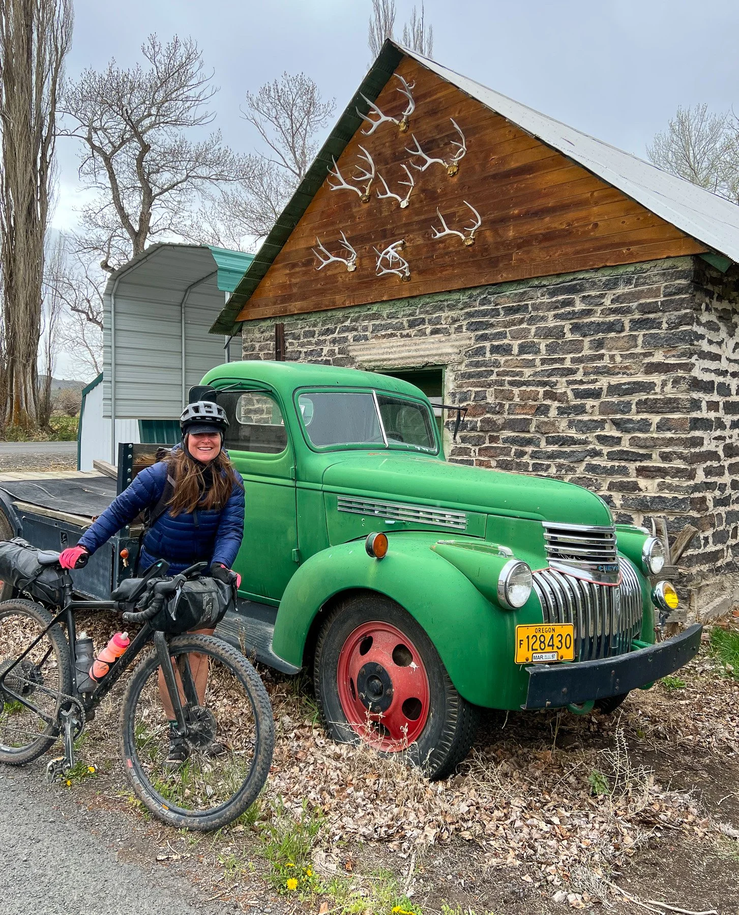
In Diamond, a touch of civilization returns. We poke our heads into McCoy Creek Inn, the only retail business I can find in this ranch town. Although it is May, we are chilled. They are closed, but we are welcome to all the water we want and to eat our own food inside, on the porch, and out of the wind. They graciously serve up warm coffee!

We are not too knowledgeable about birds, but we dawdle a bit, checking out a few varieties we have not seen before along South Diamond Road. I have plans to someday explore the gravel Moon Hill Road, but climbing back up the mountain seems more than we are up for today. With one bar of cell service, we call ahead to the Frenchglen Inn. John Ross has a room available and dinner if we can arrive by 6:30 pm.
We are up for a warm bed. I put my head down, turn south on the paved Frenchglen highway and form a mini-peloton into the brisk headwind. John rings us at 7 pm, wondering if we are ok and still coming. I mention the headwind, and John keeps the birds warm in the oven, the cooked birds, that is.

Along the way, Egrets wade in Springs canal, parallel to the highway. A diving hawk lands briefly, then rises up, a three-foot snake dangling from its talons. We arrive at Frenchglen Inn by 7:15, not quite on time, but there are two seats in the middle of the table for our family-style dinner among bird-watchers. Seems like cyclists are celebrities here, and we chat away the evening.
Showers, battery recharging, warm covers, and hot food again in the morning. Think about a stop here.

Day 3
Route:
Day 3 starts steeply up into Catlow valley. We pass Roaring Springs Ranch headquarters. A coyote watching us from caves above the springs. Hawks soar from telephone poles into the fields. Cattle graze. Just south of Roaring Springs airstrip, we head east through a gate on a dirt track into the windswept territory.
We see dust or smoke to the south, blowing eastward. Robust cattle with mammoth horns eye us as we roll past. These are not the Black Angus and Herefords of my youth. They are muscular. They don’t move away, but they at least don’t move toward us.

A white dually ranch truck, black barbed wire painted on the side, pulls up from behind us, diesel idling. Winding down the window, ranch hands fill all the seats.
“Do you know where you are?” the driver inquires, eyebrows raised.
“Yes,” I reply, “we are crossing Roaring Springs Ranch at Stacy’s suggestion to Blitzen, the ghost town in the center of the valley.”
“Yea, we heard about you.” he puts the window back up.
“Ok, thanks,” I reply. They pull off ahead, raising dust. We continue rolling through Catlow Valley.
Entering Blitzen (1888-1943), the few remaining buildings are just awaiting more wind.
“Why would anyone live here?” we say out loud simultaneously.
We imagine the first spouse asking her partner upon arrival, “Why would anyone live here?” Then as they abandon the town a few years later, “Why would anyone live here!” the spouse mutters again.

South of town, the sky turns a burnt umber as the wind increases, blowing right to left across the south end of the valley. Cattle have their backs to the wind. We struggle to stay upright, neck gaiters over our noses and mouths for filtration, the sun a red circle in the sky. Sometimes we walk, sometimes, the path disappears, and sometimes we turn east and are blown along at a clip. Sometimes we hike into the wind. We huddle behind a sand dune for a brief lunch.
We could have continued south to Coyote Gap, but the wind was relentless. We turn toward the paved road. I cannot open the chain on the last gate. We exit the ranch climbing over the gate (with a No Trespassing sign on the other side) and back onto Catlow Valley Road. It was a wonderful courtesy to be allowed to cross private land.

Turning east up into Long Hollow, we realize we haven’t eaten much. A pickup slows down, and the driver winds down the window. It’s John Harvey and a friend. They packed it out after a few days of riding.
Would we enjoy some extra snacks and some water?
How wonderful! Water is much appreciated. This serendipitous encounter will allow us the luxury of continuing in the backcountry without worrying about finding water tomorrow.
We are blown uphill through Long Hollow, the sun nearing the horizon again. The Rincon Wilderness study area on the right side is BLM land and open to camping. Above a side grade, we plant our tent in time for a painted sunset over the dust clouds. Pitched between sagebrush for the night, we are a bit protected. Anyway, the wind of the past two days finally subsides during the night.

Day 4
Route:
Day 4, we climb south into the Pueblo Mountain range. Some inholdings are private, and we skirt around those fences. Snow flurries begin as we climb up Domingo Pass. Descending the east side, we drop back into the Alvord desert basin.
Fields Station is worth a stop for a hot dinner, and we meet a hiker on the 1200 km Oregon desert trail doing the same. He has been walking for a month and just descended from the top of Tse’tse’ede. We compare notes and rest up a bit.
A few more surprises await. Back on the bikes, the snow turns to rain as we pass Alvord Lake and Andrews, offering up a full rainbow.


Arriving back at base camp as the sun sets, our basecamp tent is gone; only stakes remain in the ground. Apparently, it was just as windy here as in Catlow valley, and our tent departed up into the atmosphere and now perhaps rests somewhere across the playa.
Desert rain continues as dark settles and the Alvord’s mud begins to soften. I walk out onto the mud and reason that it is still drivable but may not remain so for long. We hustle the bikes and gear into the car. It is time to depart across the mudflat.
I cannot guarantee you would receive permission to ride the same route we did, given a portion of our route passed over private land. It is an impressive loop around Tse’tse’ede, and there are other dirt roads that are rideable.
Ignoring politics, it seems to always pay to make friends with everyone you encounter in the backcountry. You never know when you will need help or when you might be able to offer help to someone else.
We said hello to everyone we passed.