
The Castle of Gedelme

In continuation of exploring the wonders of Turkey, I ventured southwest of Antalya along the Mediterranean coast and upwards towards the Cotton mountain peaks, passing by the historical Castle of Gedelme hidden in a narrow valley within the western Taurus mountains.
Turkey captivated me, and the stark differences in topography across minor Asia will enchant you too.
Toward the end of my stay in Antalya, I still haven’t had my fill of the steep roads of the Taurus. With my lack of fitness back then, every ride destroyed my legs and opened my eyes to more places I wanted to explore.
While scouring the maps, I landed on a castle in the middle of a valley I hadn’t ridden to yet. Naturally, I built a route to check it out, and I’m glad I did. This route offered a great balance of hard climbs, amazing food, and killer scenery, per usual.
The Route:
Ride Report:
I left Hurma early in the morning to avoid heat and traffic on the main road alongside the coast. It’s a sight to see, for sure. The shoulder on the road is wide enough for a few cyclists at times, and the views of the Mediterranean to the left are unmatched.
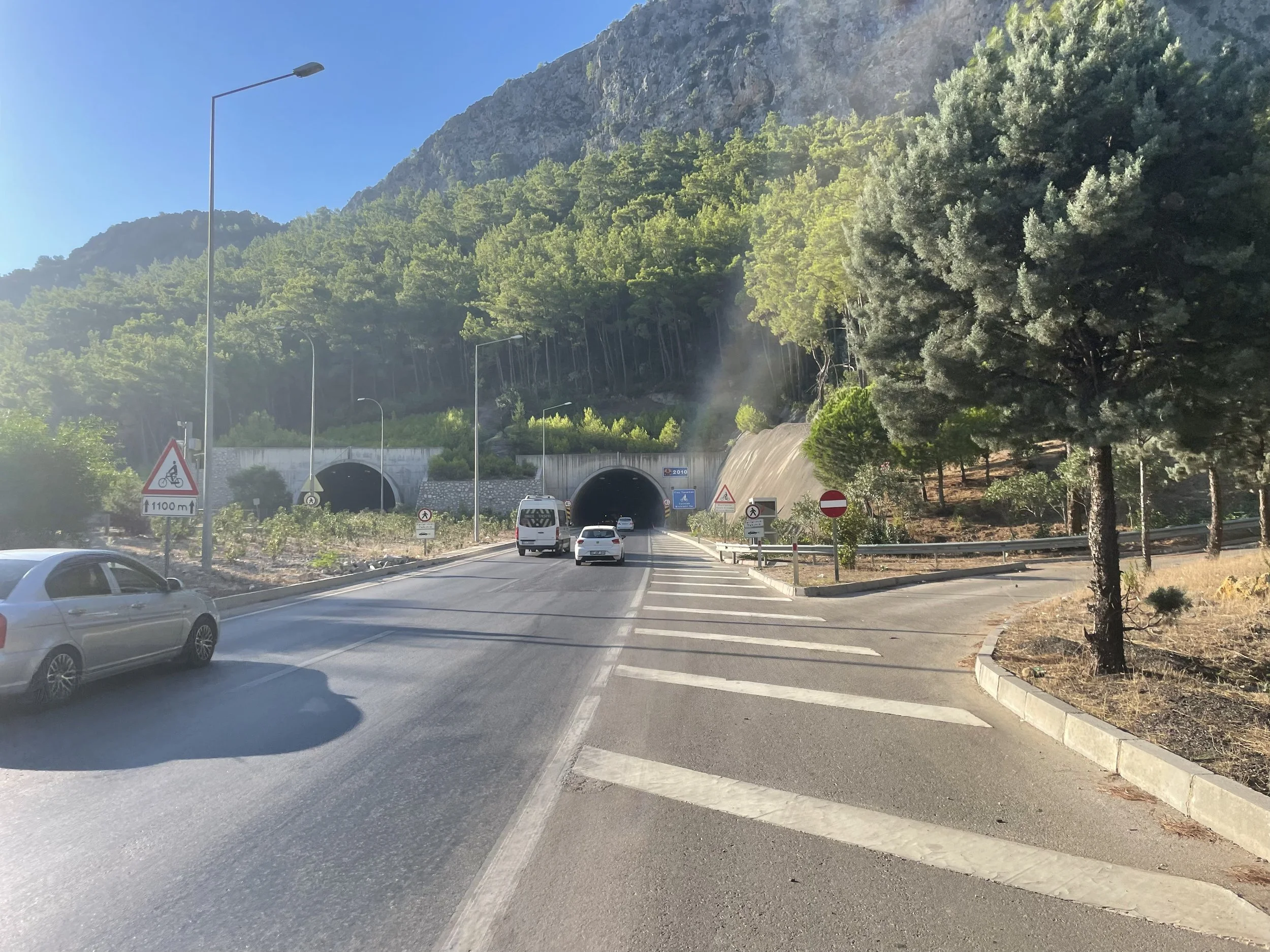
Antalya boasts a rather rugged mountainous terrain, so even on the “flats,” you’ll climb up kickers, pass through tunnels, and descend into beach towns scattered across the coastline. It made sense to ride the coastline to the bottom of the narrow valley, which starts from the town of Kemer.
Along the way, the cool morning sea breeze set the mood for the flat & busy 22-mile stretch to the climb. With every little town I passed, I got hit with the smell of a woodstove & buttery Gözleme, a famous pastry dish found all over Antalya, and especially in villages across the mountains.
While I was drooling over my first meal on the ride, I snapped out of daydreaming about food when I ran into another cyclist. As much as Antalya is known as a cycling hub, I rarely ran into other cyclists during my trip. I rode along with the fella all the way to Kemer, my exit.
As for cyclists in Antalya, the ones I ran into were like butterflies flying up the steep hills. Simply strong riders.


The first 22 miles were necessary goodness to get to the base of the climb. However, as soon as I exited the main road, I saw the familiar white peaks of the Taurus mountains. You can’t tell where the clouds start and where the peaks end.
The gradients compounded with every mile I climbed, passing alongside the faint Kuzdere River trickling down the narrow canyon. As usual, I’m easily stopped in my tracks, especially in Turkey. I saw a small waterfall spilling over a dam from a distance, and the water sparkled under the intense summer sun.
Snailing my way up the canyon, I was passed by a caravan of jeeps loaded with tourists headed up the canyon. I caught up with them up the road by a viewpoint. A few people waved and gave thumbs-ups, but one person started walking toward me. “I should’ve brought my bike! This place is fantastic,” said the guy from Italy. We spoke a bit about the riding in Antalya and how it is a true hidden gem. Turns out that he vacations in Turkey often and rides there as well.
They loaded into the jeeps, and I saddled up.
The mountains were waiting, and time was passing by, so I needed to keep the momentum going.

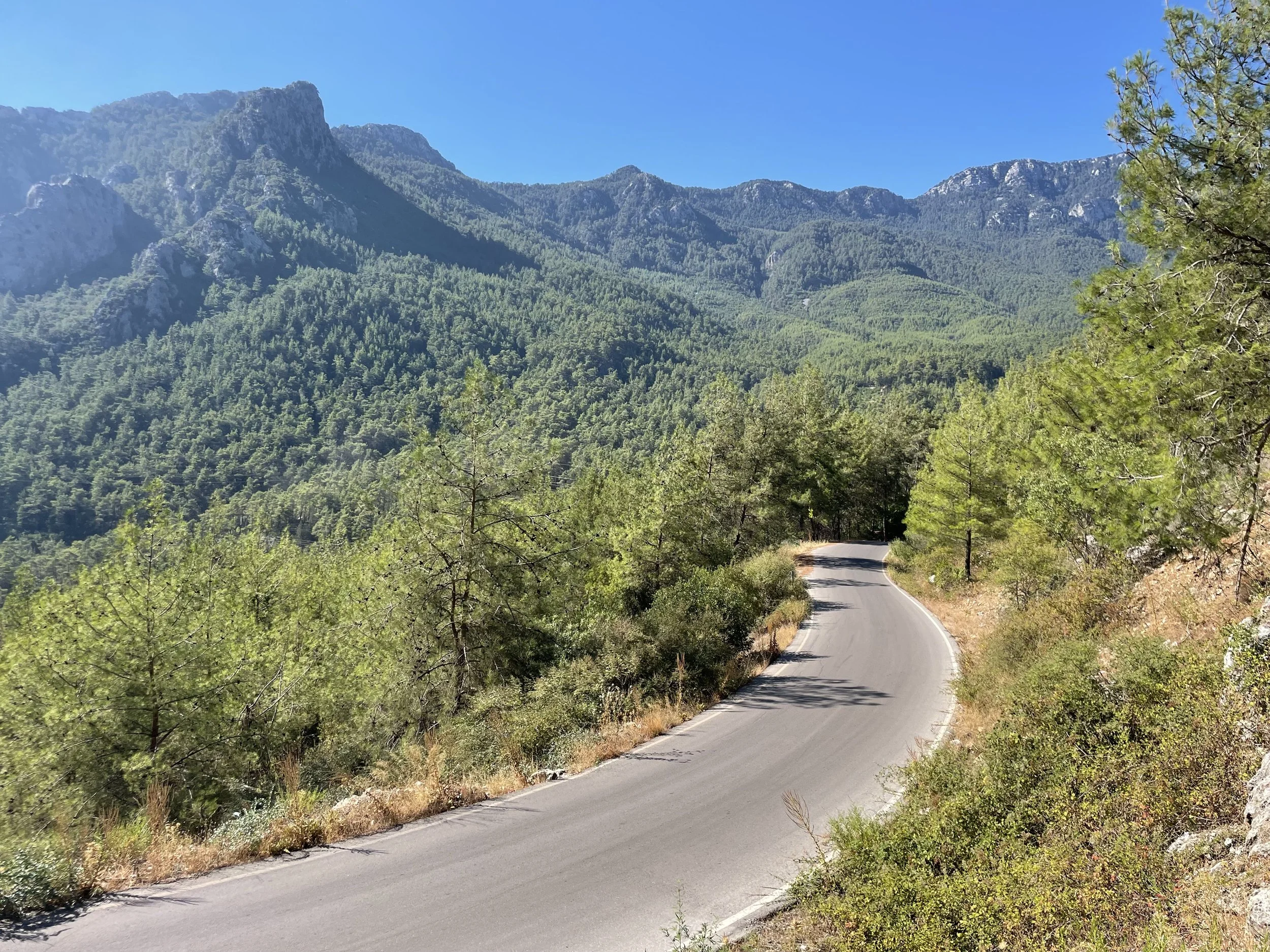
The more I climbed, the narrower the canyon became, compressed into a tight gap barely able to fit the road alongside the Kuzdere River. Nature is the best architect. The trees closed in above me, and the mountainside grew taller as if I biked through the gates leading up to the Gedelme Platue. A small dip on that climb toward a juncture ahead revealed the magnificence of the valley. At this juncture, I found a Roman bridge fully intact, leading to a mountain-style cafe. Again, that familiar wood stove and buttery Gözleme aromas filled the air around me.
I made it past the narrows and landed at the footsteps of the Gedelme plateau!
With the first switchbacks on the route, I was already geared out. If you have used routing tools such as RideWithGPS, Strava, or Kamoot, you know that the numbers on the ground always differ from those on the maps. This was the case here. A 14% to start off with.


The quaint roads of the Taurus are addictive, regardless of how steep they are.
Now under the tree cover, the air is always cool, rushing down the mountains and carrying the smell of the forest with it. Pine, fresh streams, and nearby wood-burning stoves from houses scattered across the mountainside.
Sounds like perfect climbing conditions.
As you climb the mouth of the Gedelme plateau, more peaks start to unveil themselves, like towers above you. The watchers and keepers of these ancient mountains with ruins all over the area. The steep road leading up to the village of Gedelme cut through a dense pine tunnel sharing the land with fallen limestone rocks covering the forest floor.
At last, the castle was in sight, peaking above the dense vegetation and growth all around it. A small main road cuts through the heart of the village, in front of its only store. I followed the cobbled road up to the base of the castle. On the way, I saw a familiar person, the same Italian dude from earlier, waving at me. They took the long way around the Platue, circumnavigating the area off-road.
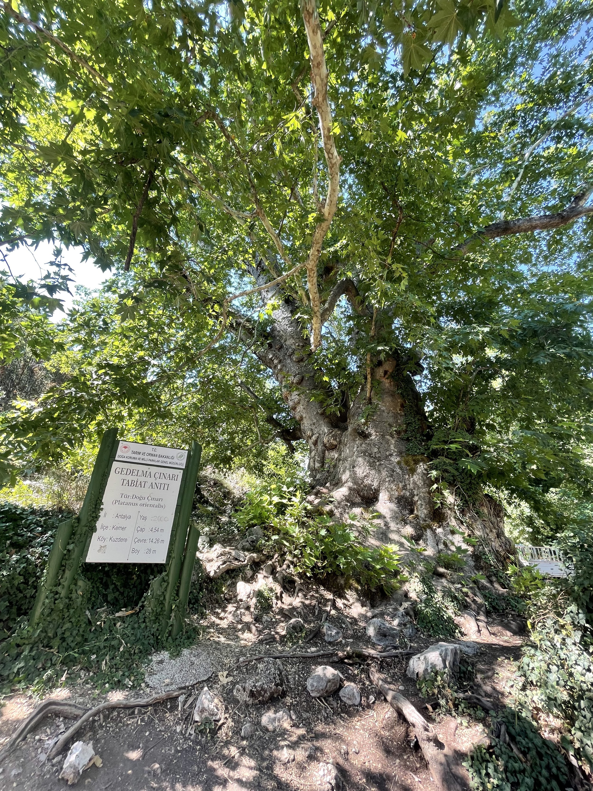
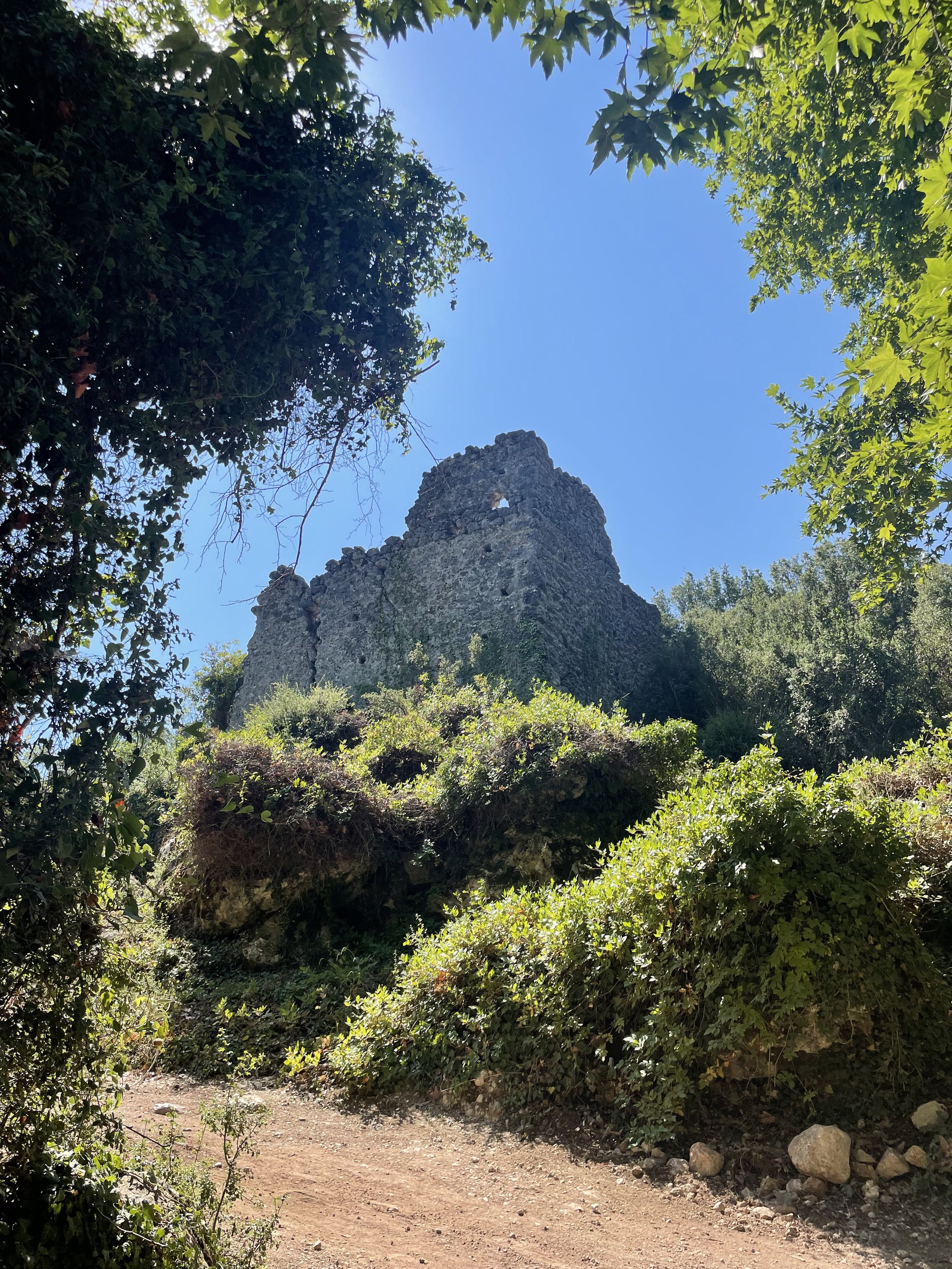
I barely saw much of the castle since the majority of the area was densely covered with vegetation. But what I managed to see was already cool enough. At the base of the castle, you’ll find one of the oldest trees in the area, a 2000-year-old Sycamore. Just to think that thousands of years ago, this place was bustling with trades that spanned all the way to the Silk Road.
Just mind-blowing to me.
As is the case with my articles about Turkey, I struggled to find much information about the history of the places I visited. However, from what I could find, the Gedelme plateau falls on the historical Lycian Way trail. Which runs alongside an old famous trading route for thousands of years.
The Genovese built the castle of Gedelme to protect the trade route down to the coast.
It was also used as a storage for grain, most likely gathered from the upper plateaus. I recall chatting with a few guys forging wild grains from the upper plateau on my ride to TUBITAK. So wild grains are abundant in the region.
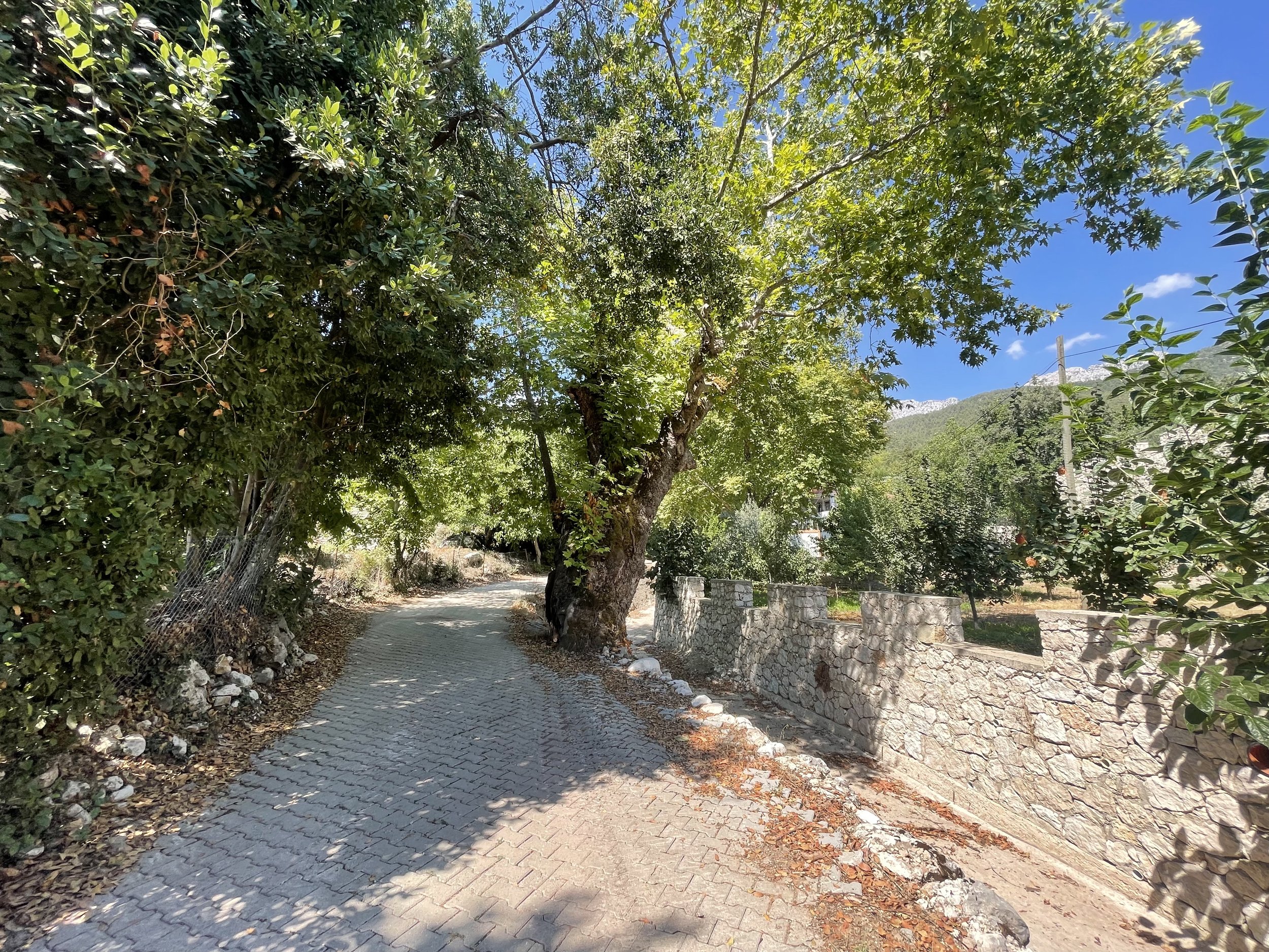
Gedelme sits about halfway up the long climb to the ridge, where I planned to drop down to the other side and back into town. I stopped at the Cami (mosque) in the village to fill up on water before trekking up the second half.
Noon arrived, the sun was beaming down, and the cool mountain breeze was balancing the sheer difficulty of this climb. Then, past the village came the most challenging part of the climb. What stood between me and the summit was about 6 miles, with 2200ft of elevation gain.
However, that stretch was also the most epic part of this route.
The first kicker sets the scene, a long stretch leading you above the tree line, exposing the surroundings. Still, the southern granite wall blocks the view of the Mediterranean for now. Interestingly, although I rose above the tree line, I entered another kind. I knew I was getting close to the summit when I started seeing Lebanese Cider around. As they mostly exist in higher elevations.

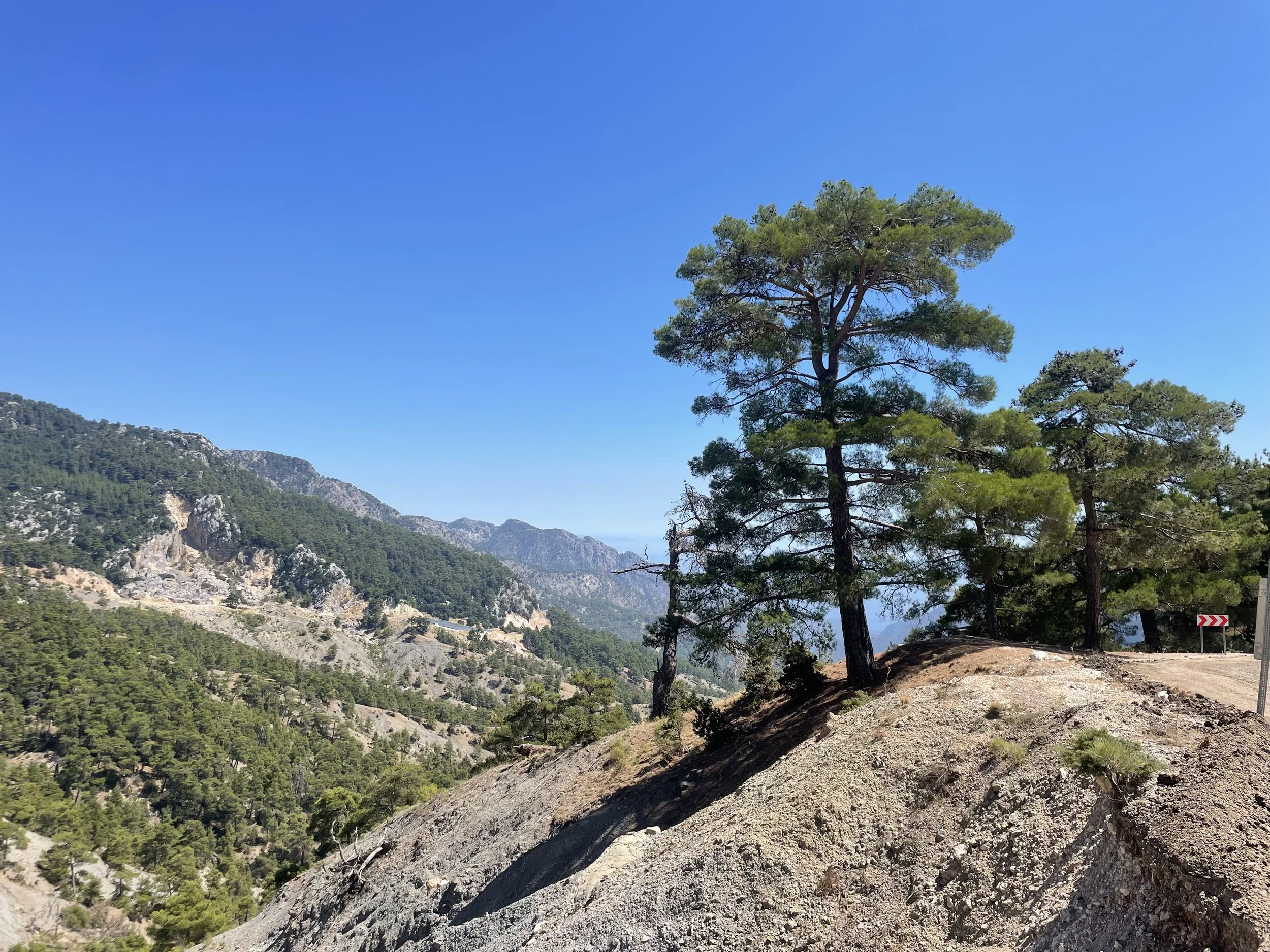
These remote islands of farms and cottages dot the horizon, barely hanging onto the side of the mountain. They are uniquely Taurus.
Standing on a razor's edge, the summit was in sight, and so was the Mediterranean, from +4000ft.
As glad as I was that the climb was over, I wished it was just a bit longer. But of course, you only realize that when the journey is wrapping up…
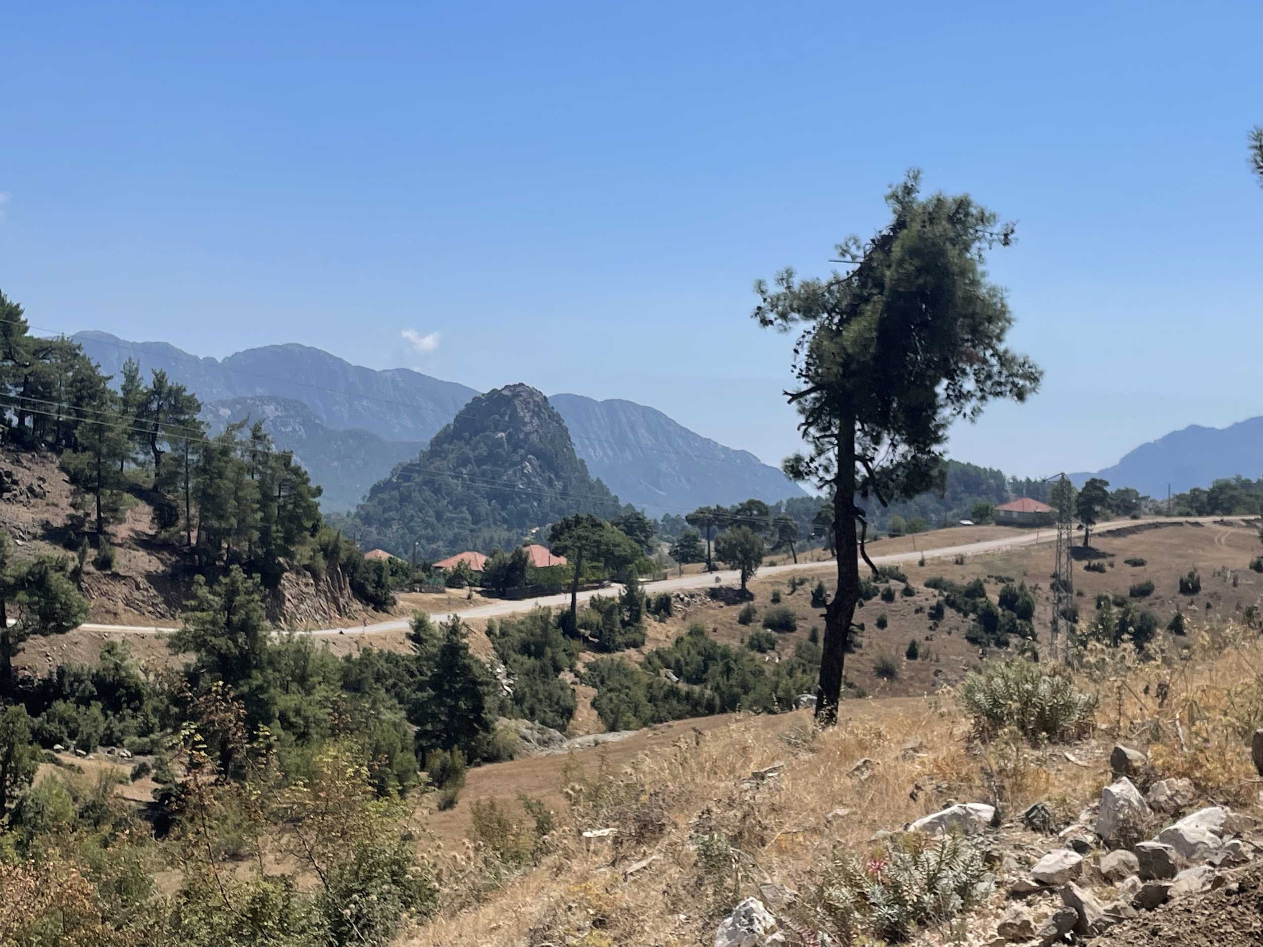
Alas, I paid my climbing dues, and now it was time for the long and much-deserved descent back into town. This route shares the same descent as the Circumnavigating the Çandir Stream Valley.
Fast, edgy, and borderline addictive.
The more of the Taurus I explore, the less I see of it. A bottomless bowl of wonders, history, and adventure.
Seriously, add this place to your bucket list.
