

From Lava Fields to Palm Groves: AlUla Gravel Loop
By now, you might've heard or seen something about AlUla, think team Jayco’s jerseys, AlUla tour, and the Mada'in Saleh (Hegra), and then some more. Al-Ula has been a hot spot (no pun intended) for tourism over the past 7 years, and I happened to visit the area myself for work, and yes, I brought my bike.
The geography is stunning and vast, changing dramatically depending on the direction you travel from the center of town. Travel east, and the mountains get swallowed by the red Al Nofoud sand. Travel north or south, and the scenery shifts into a more rocky landscape. But head west, above the mesa, and you find an ancient blast zone, covered in lava flows as far as the eye can see. You are in a volcanic land. Saudi Arabia is massive, covering roughly eighty percent of the Arabian Peninsula. The variation goes far beyond sand dunes and flatlands.
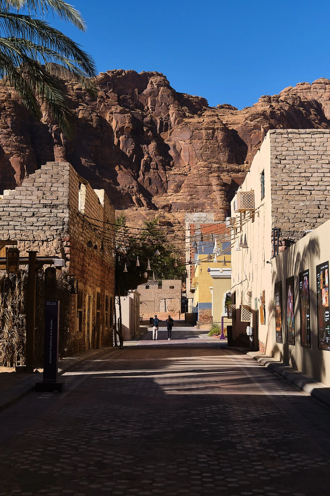
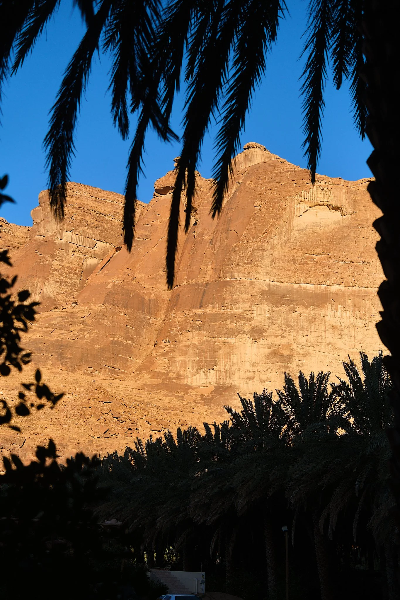
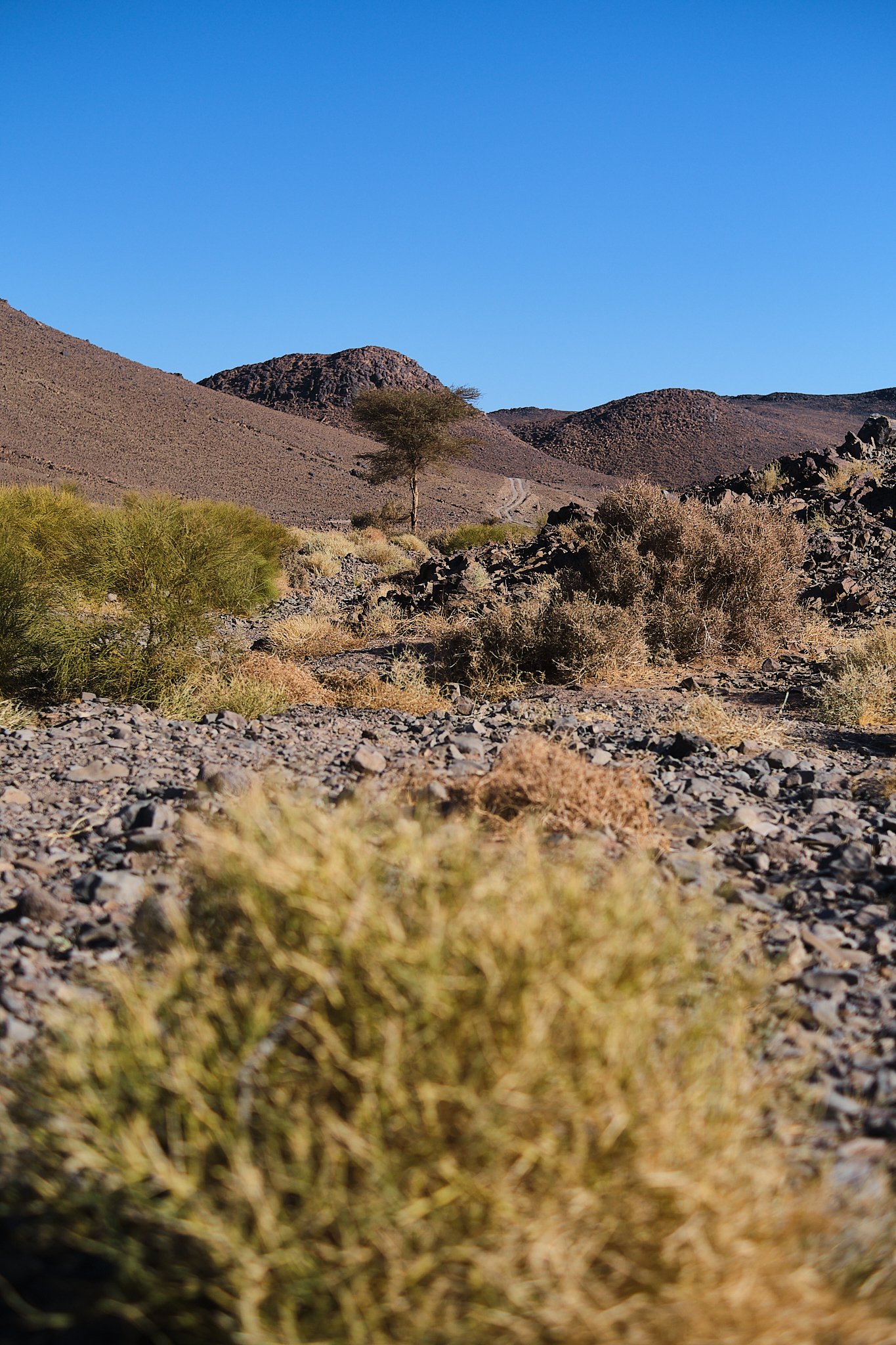
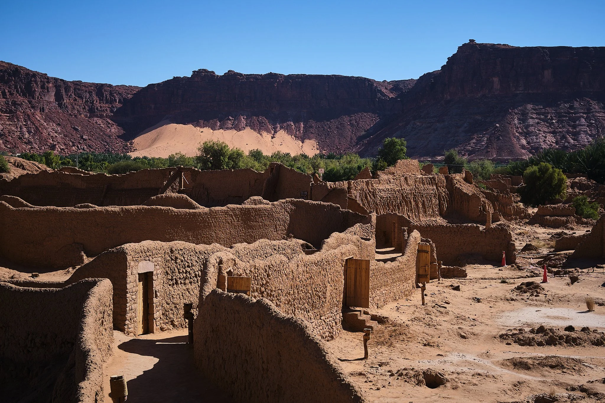
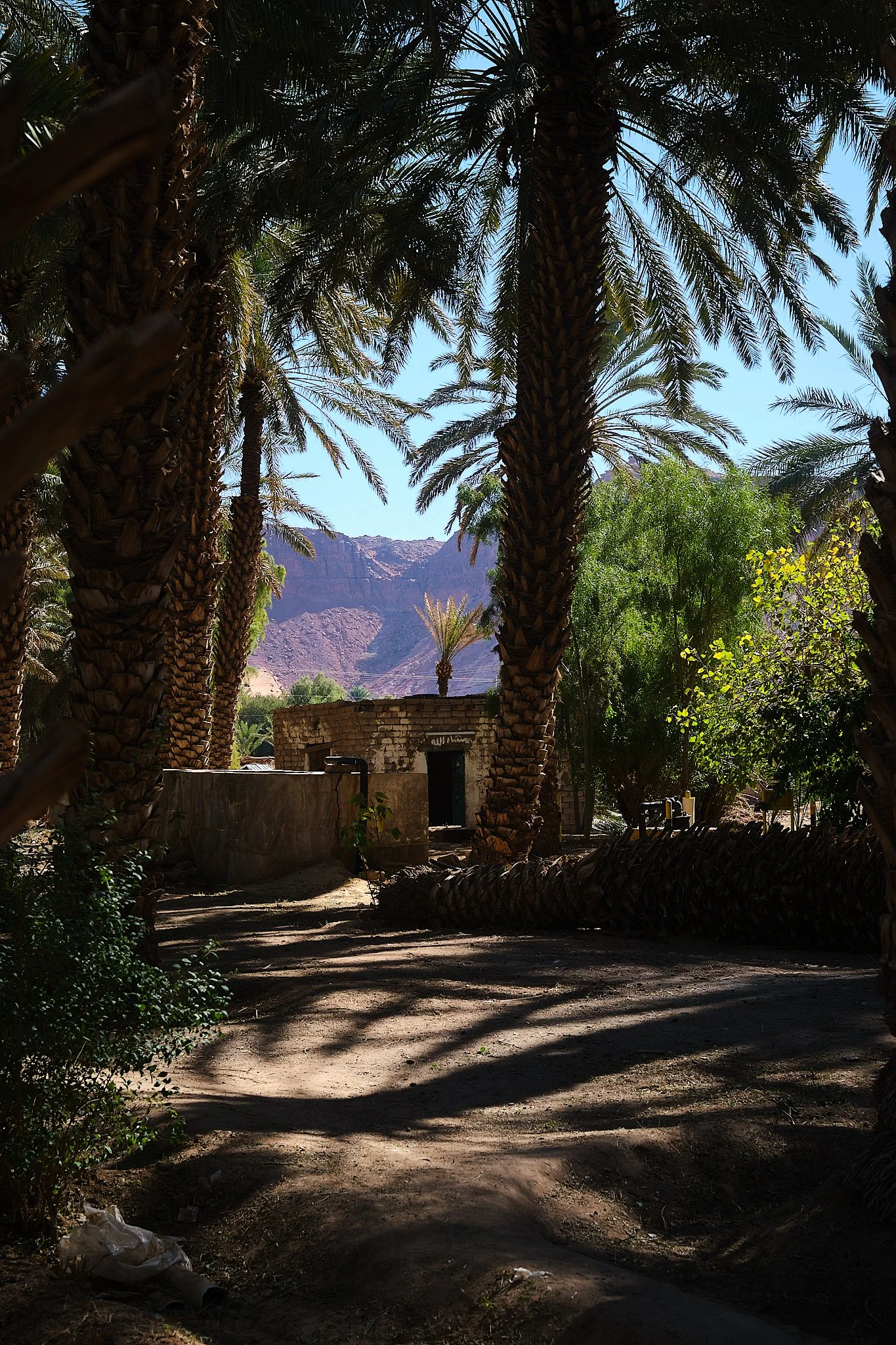
Al Ula was home to the Dadanite and Lihyanite kingdoms, who carved their homes and history into the cliffs long before the Nabataeans arrived. At its heart lies a vast oasis that has sustained travelers for thousands of years, fed by natural springs and millions of date palms. The burst of green is a wild contrast to the charred black volcanic rock of the Harrat (lava flows) to the west and the sandy, rocky desert to the east.
The roadie scene in the area is already well documented, and to be frank, it's lackluster beyond the scenic backdrops, unless you’re into the long stretch of great pavement in full sun. However, I tend to go where the roads get rough or, preferably, disappear, and I found the perfect mix just west of town.
This short mixed-terrain route can be extended, as there are so many options once you climb up the mesa, but I’ll introduce this version and hope to inspire you, fellow readers, to build on it.
The Route:
*Longer version at the bottom
Ride Report:
Location: AlUla, Saudi Arabia
Surface: Mixed Terrain
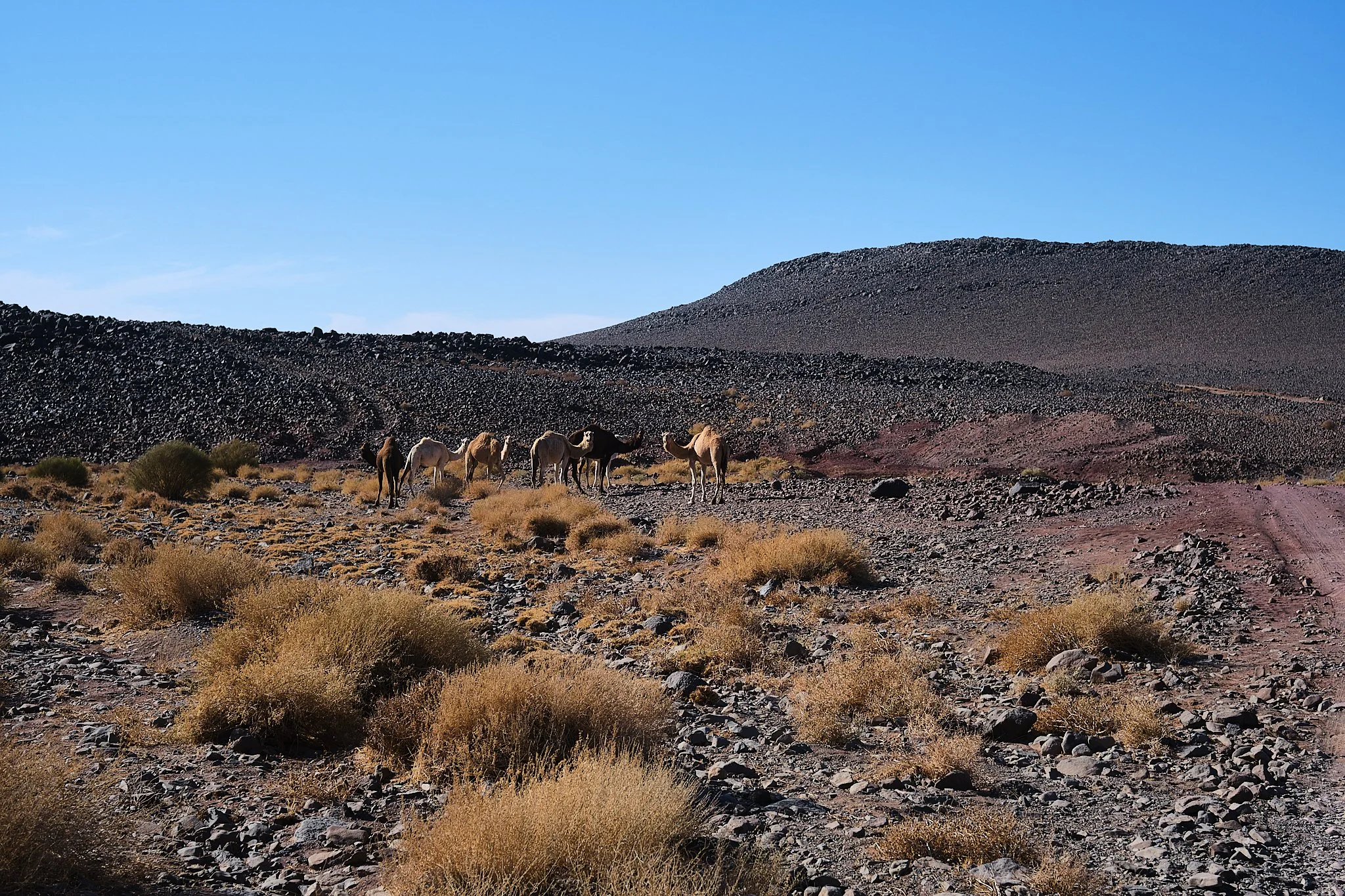
Camels: Most likely
Palm groves: over 1 million trees, so yeah.
Climbs: 1 Stupid steep climb, but its cool.
Water refill: In town only
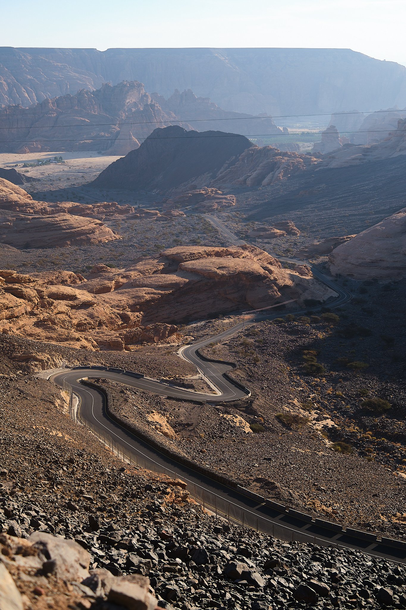
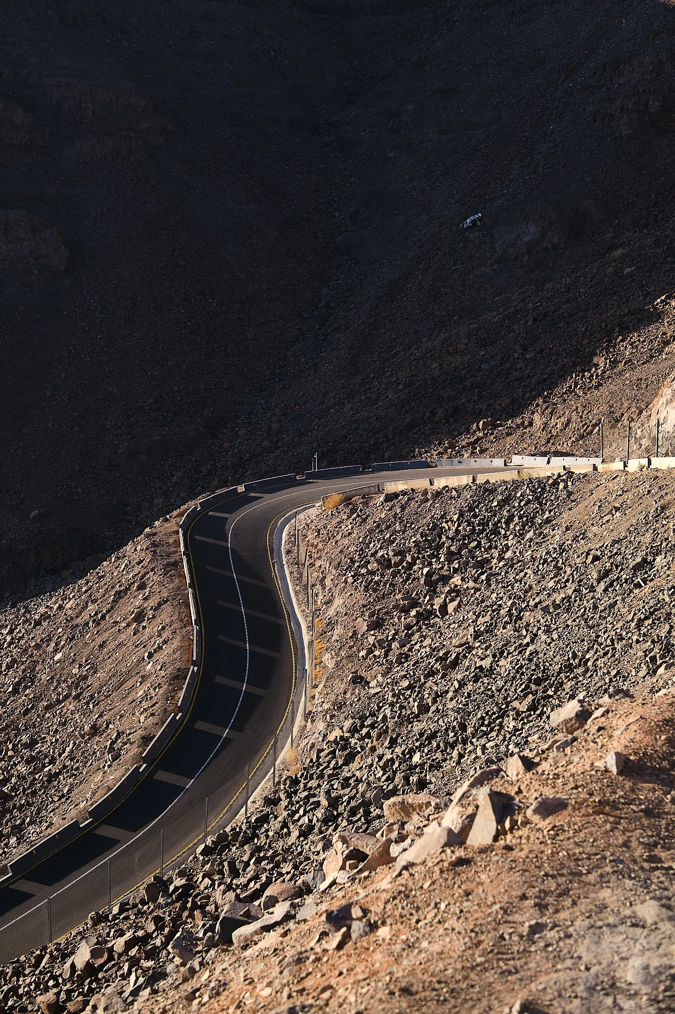
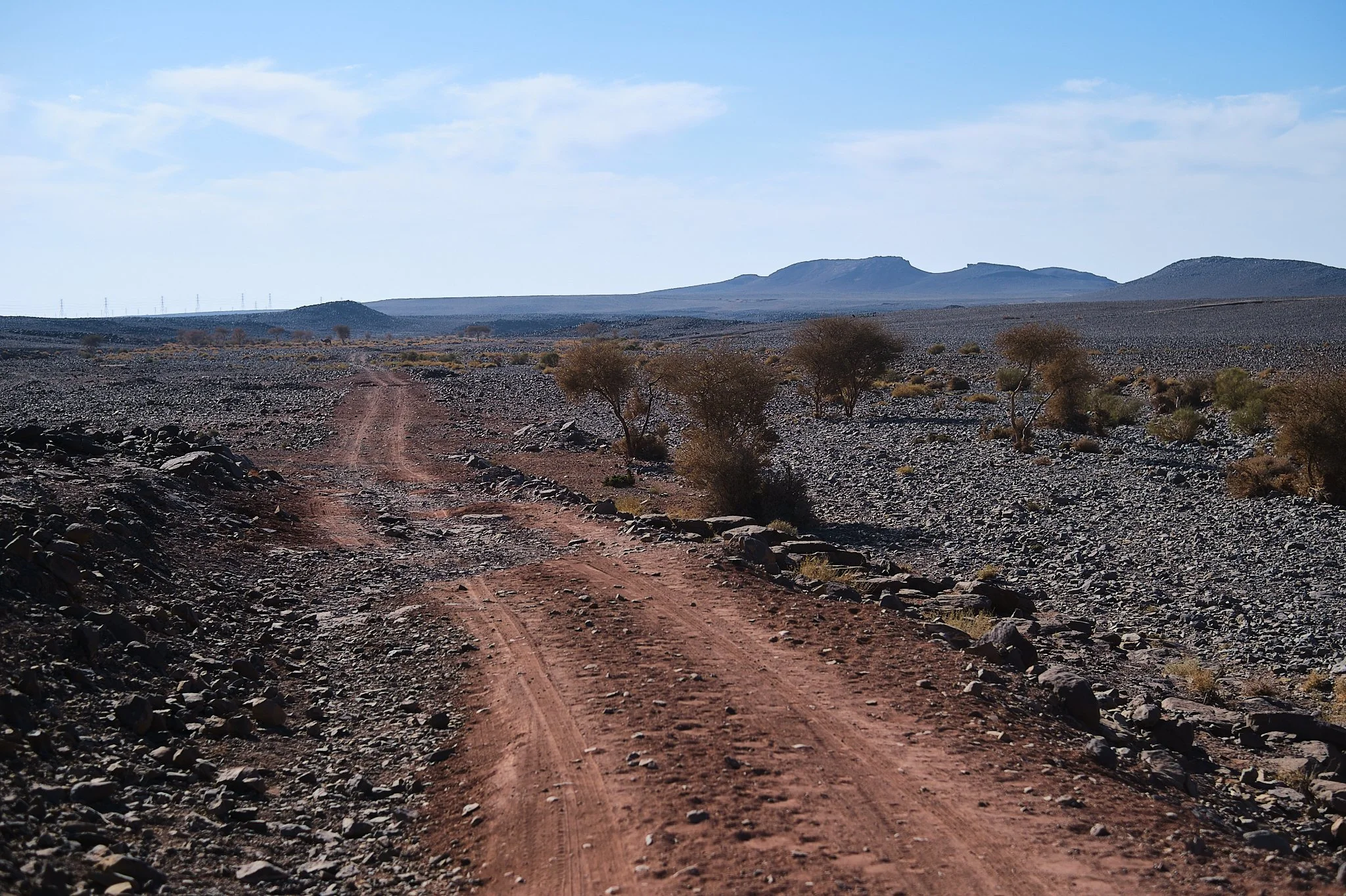
The route starts at the Dadan Heritage trail, in the heart of the palm groves, and right by the red cliffs where Dadanites carved their homes. You can spot the carvings from the road as you bike north. Once past the highway, you’ll see the ominous, steep road snaking up the cliffs in front of you. You’ll be riding up that; it’ll be super steep in some sections, but hey, that’s part of the fun. The only catch is, don’t drink too much of your water just now. The hairpins offer some respite and a good place to let cars pass. The views get way better as you ascend above the sandy canyons where Al-Ula sits; it honestly reminds me so much of Moab, just a bit sandier.
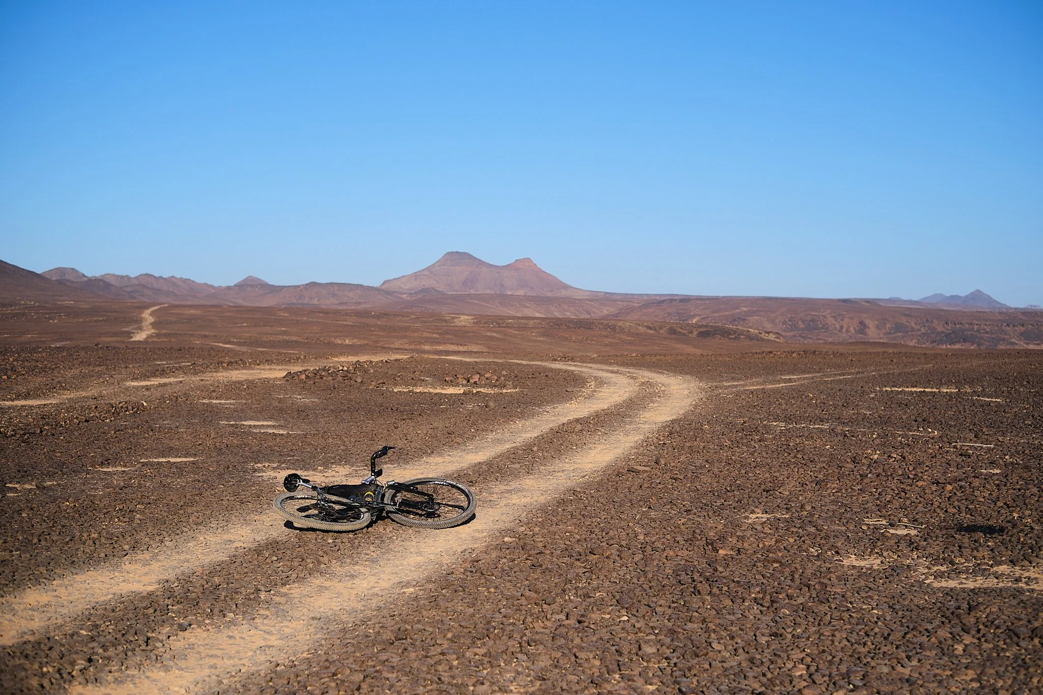
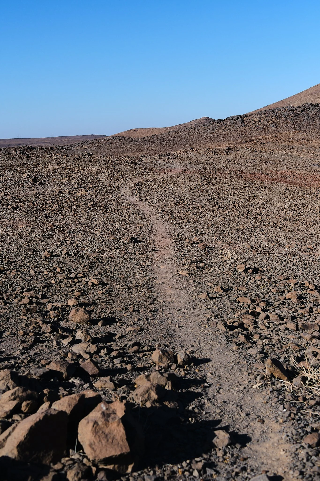
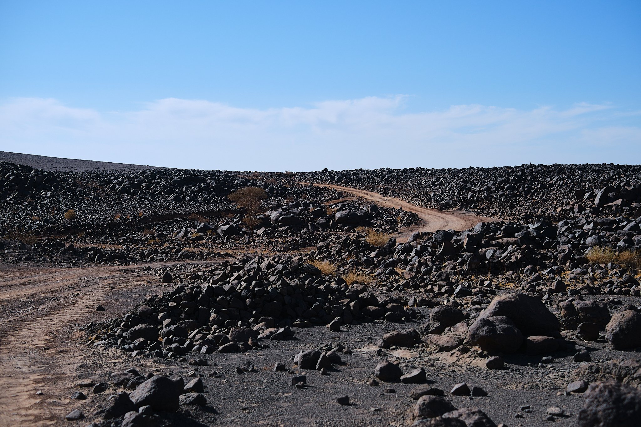
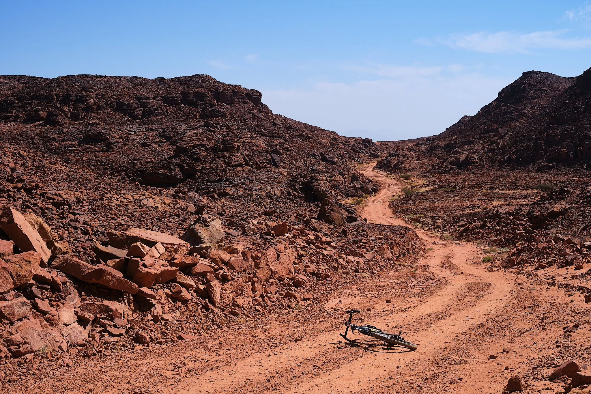
Gravel starts right at the top of Alharra, a doubletrack path on the right side of the road.
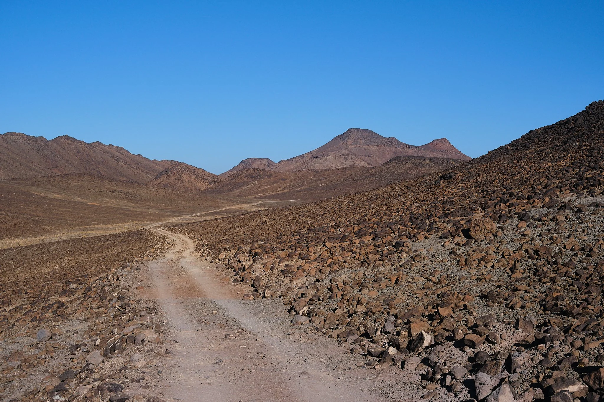
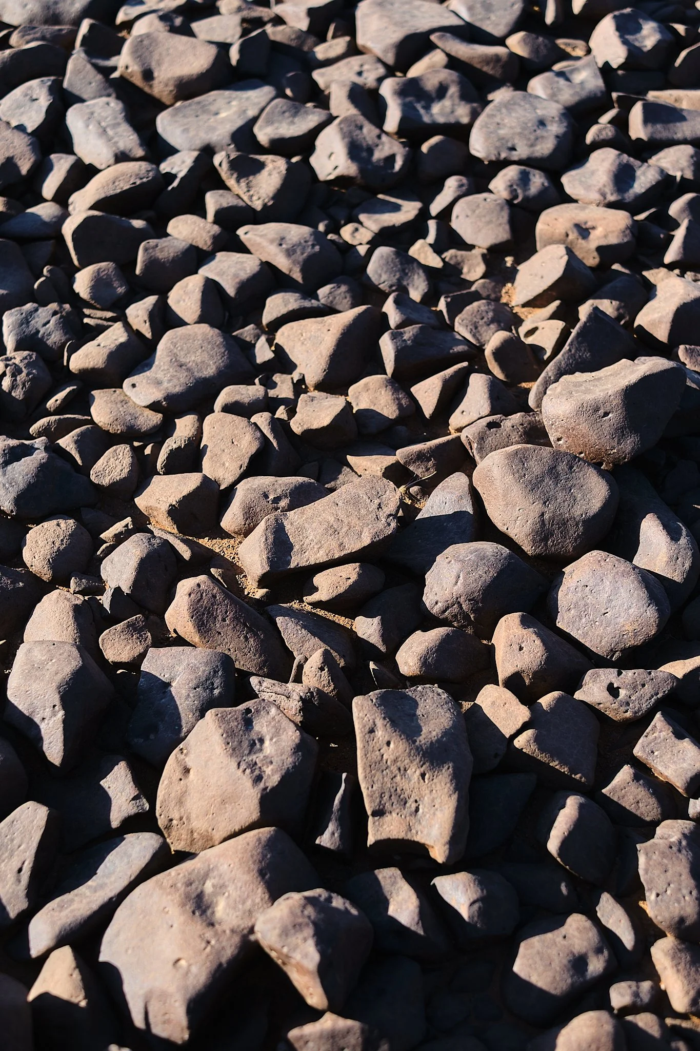
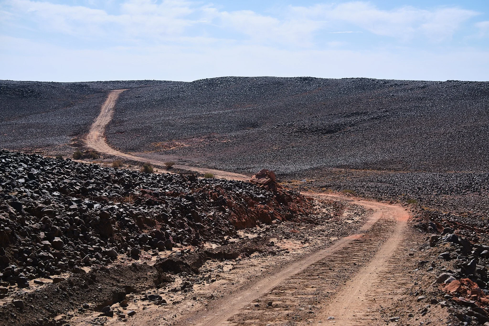
The terrain up there is rocky in sections, even bouldery in some, but it ebbs and flows between a mix of everything as you ride through the area. In some sections, like at mile 12, you’ll see some camel trails cutting through the landscape that eventually connect back to the route. However, you can remain on the main Radmiya (gravel road) if that’s not your jam. But if you’re curious about what led them camels through there, you might as well trek along.
One you turn, the route pretty much flattens for a while. Come mile 13, the surface changes from basalt gnar to a mix of smooth riverbed doubletracks with the occasional rock garden that adds a bit of spice on your way south.
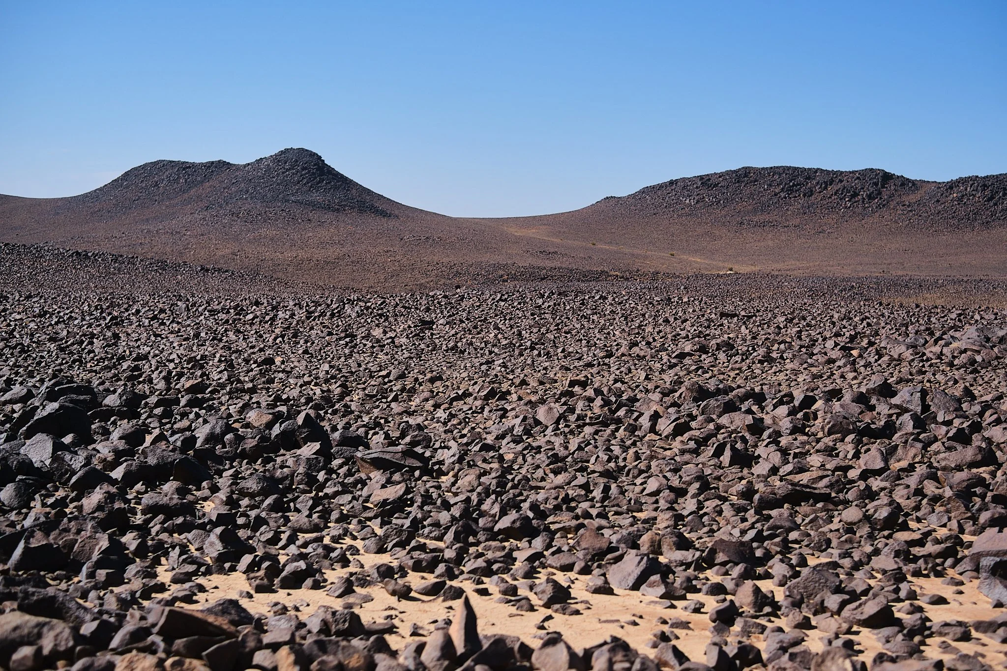
As you could see in google satalite or even once you’re up there a handful of optional tracks that parallel the route as you travel south, some of them do run true and eventually connect back, others, however, veer off into a dead end, someone's campsite, or somewhere far, far away into the lava lands. So explore with caution. The main route runs along the powerlines, which is the smoothest gravel option up there. However, Rain can make or break some sections due to erosion, clay, and more, so mind the gaps that can show up without notice. However, if you’re feeling adventurous, there is a rocky doubletrack option west of the power lines behind the two black dome-shaped hills right around mile 20.

It's really cool, I saw camels there, so yeah.
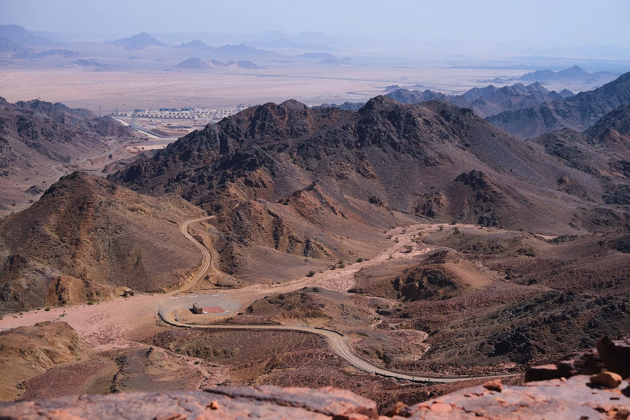
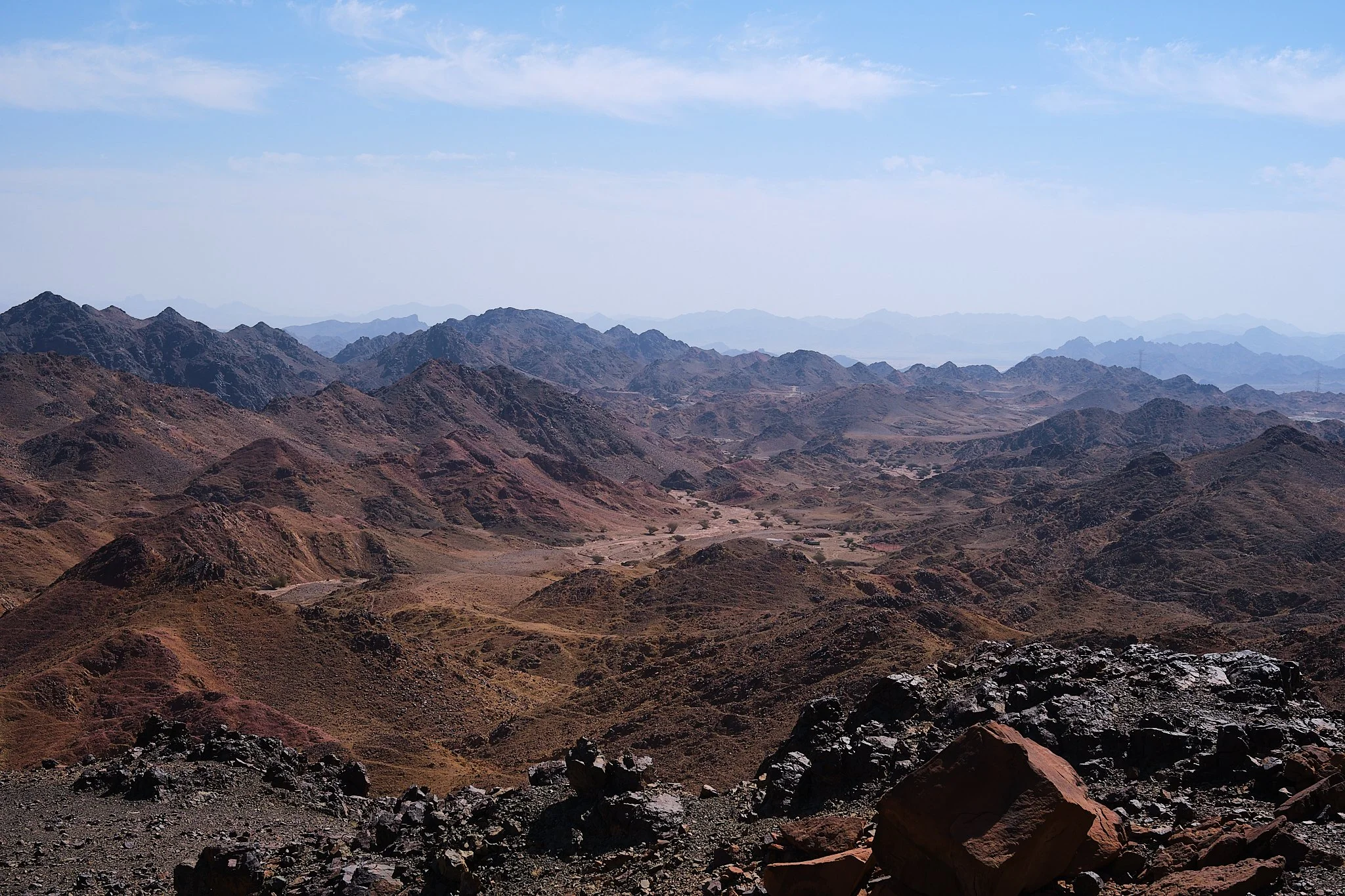
Eventually, though, you’ll have to ride under the powerlines as there is little to no option elsewhere, for the next 6 miles before turning right. By now, you would’ve been just riding on top of Alharra with views of far volcanoes dotting the horizon in a sea of black rock, but just a few more miles down the road, a dramatic reveal awaits. some shifting in the layers.
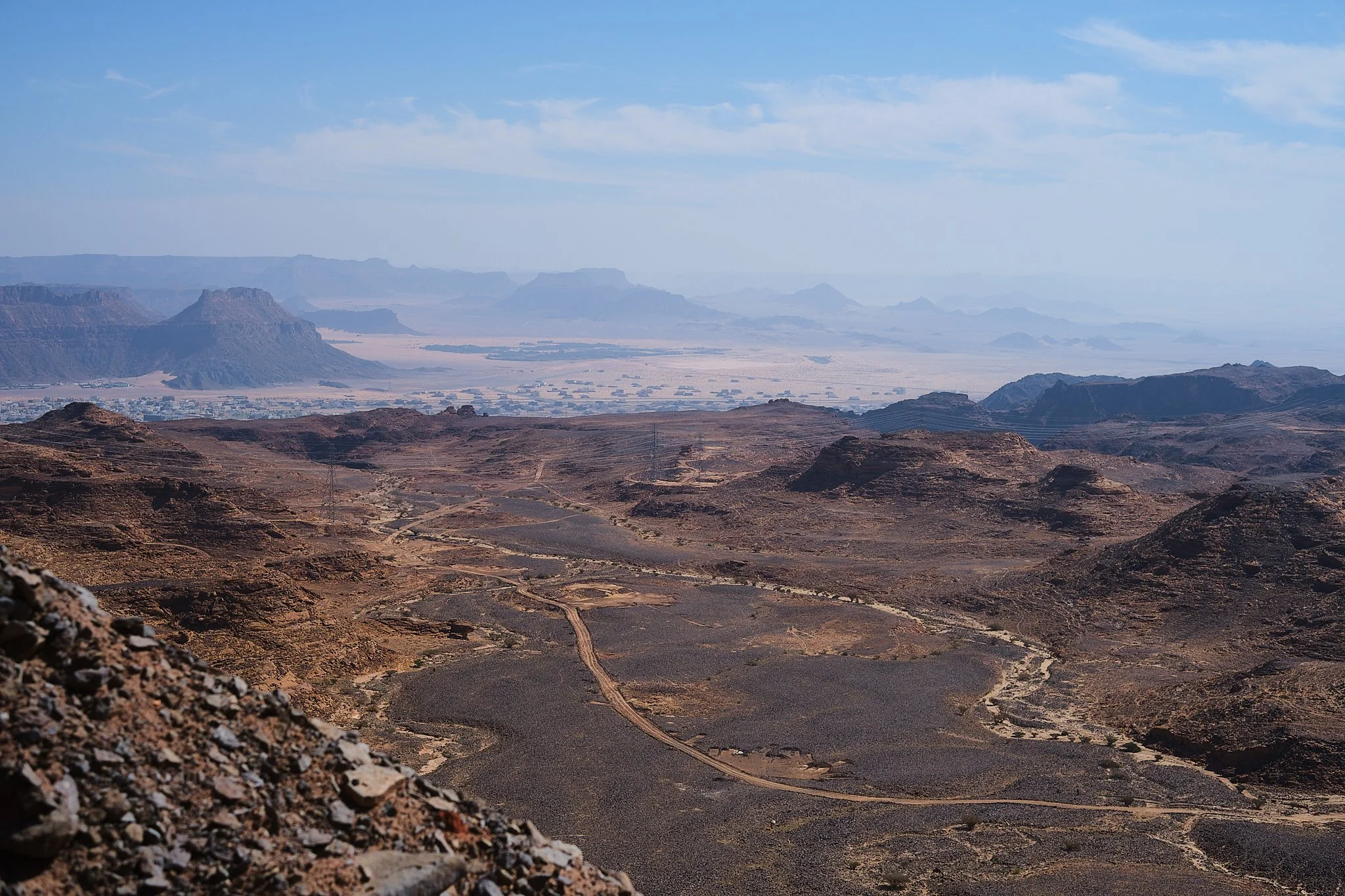
Take it all in: the vastness of the canyon, the steep red cliffs shooting straight up through the sand, and the rocky pass you’ll descend shortly after your pondering session.
Here, suspended between the black lava flow and the red cliffs of the canyon far ahead, you witness how millennia of wind and sand have patiently carved these lands into these awe-inspiring views.
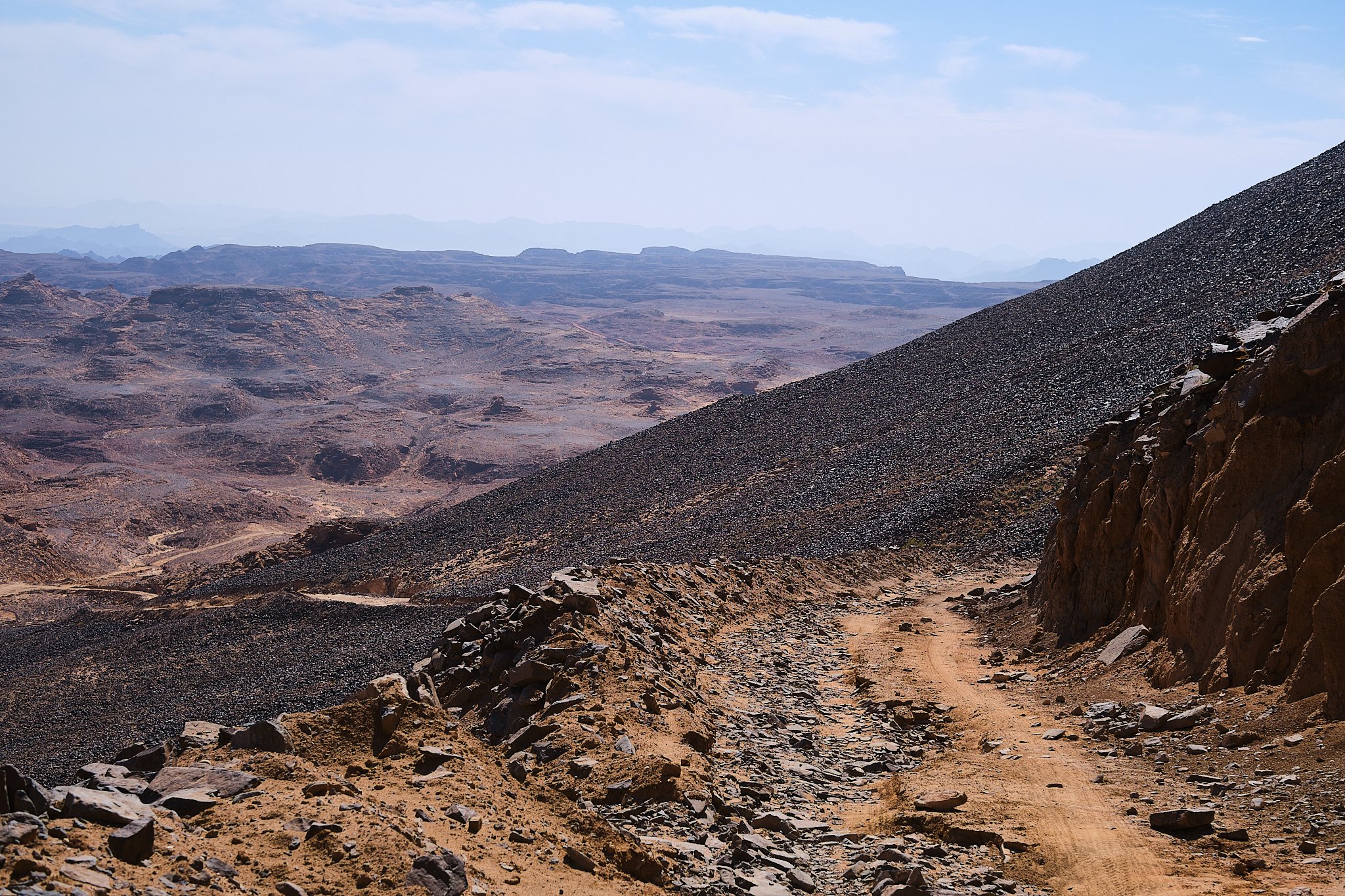
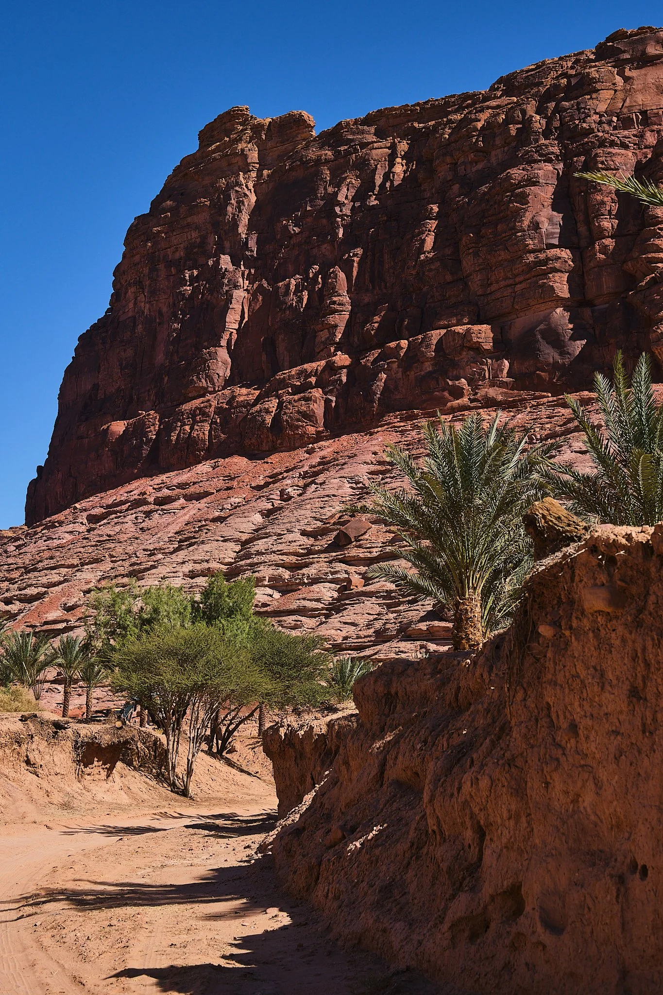
The drop-down from the mesa is a bit on the loose end, so stay alert for sandy pockets. As you descend the wall, on your right, you see the layers of rock and lava, getting older the lower you go, and then at the bottom, the earth suddenly turns red. Leaving the lava lands behind you.
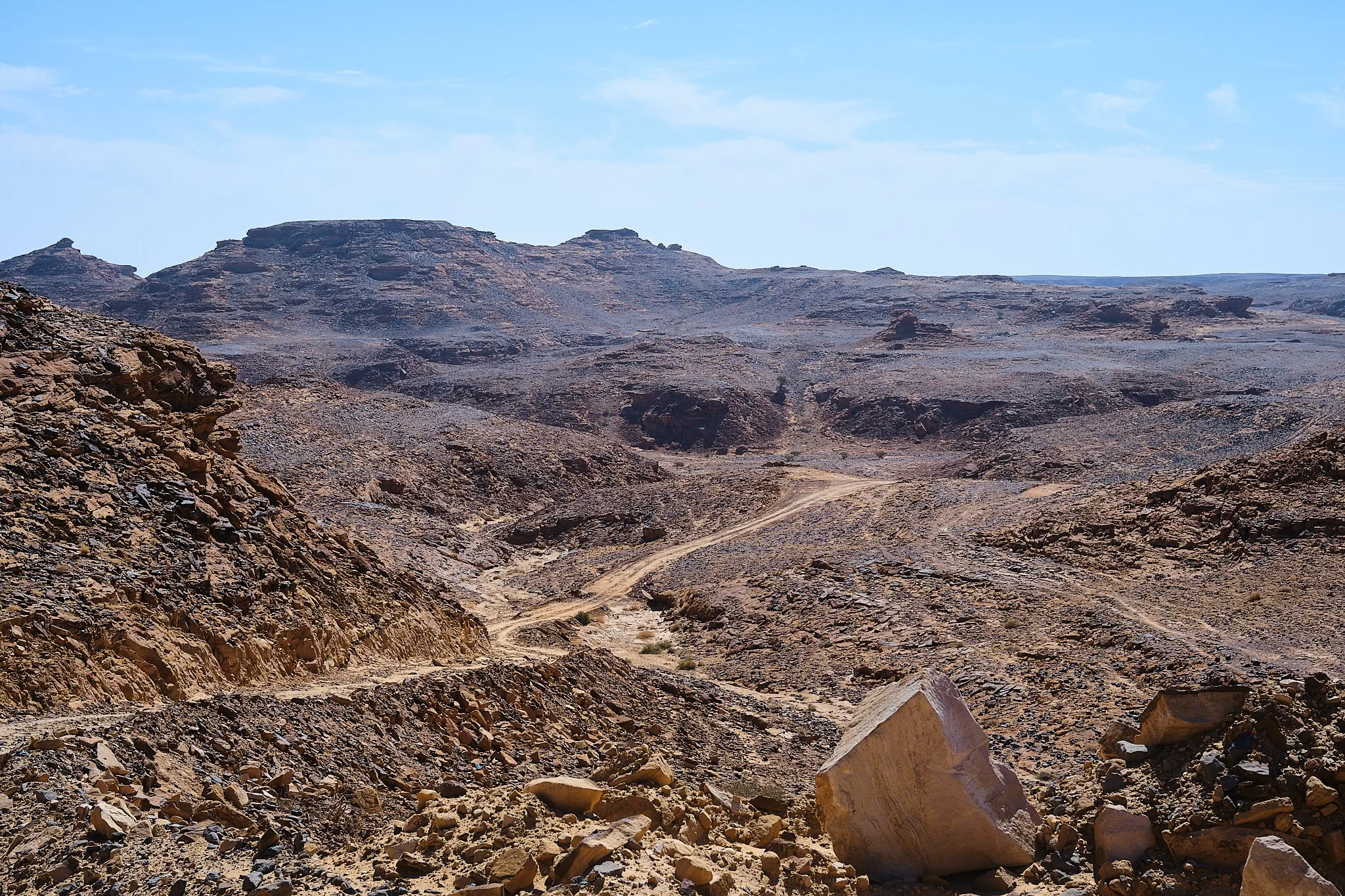
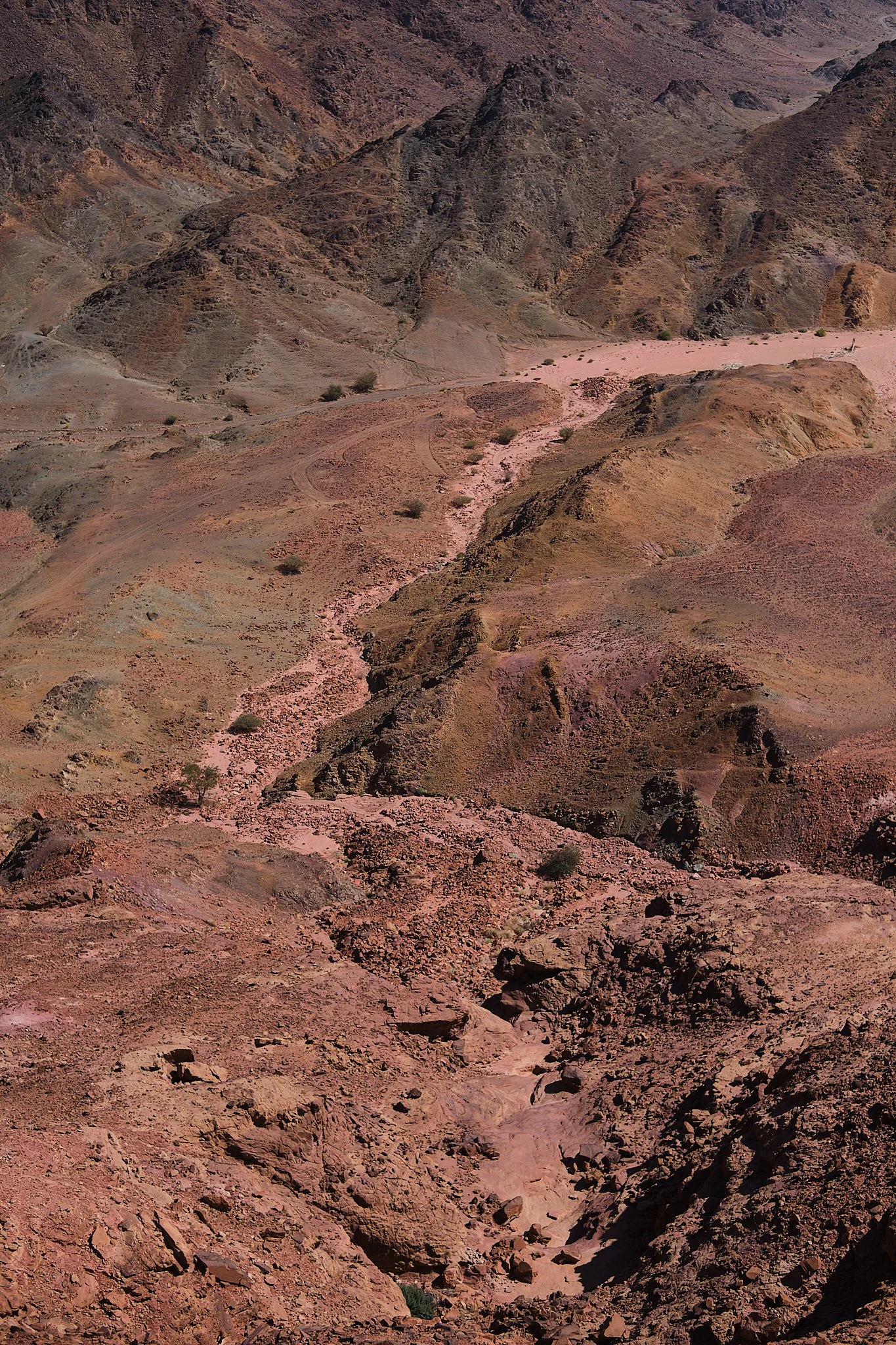
The road meanders through the red cliffs and narrow wadis, which might have some remnants of recent rain.
And then suddenly another sheer drop reveals itself once more, with a bit more developed road this time, so you can safely send down the last bit of gravel.
At the bottom, you have two options: either follow the route through the wadi by turning right, or continue straight towards the steep climb due east. It's short, rocky, but worth the effort.
And just like that, you’re on pavement again.
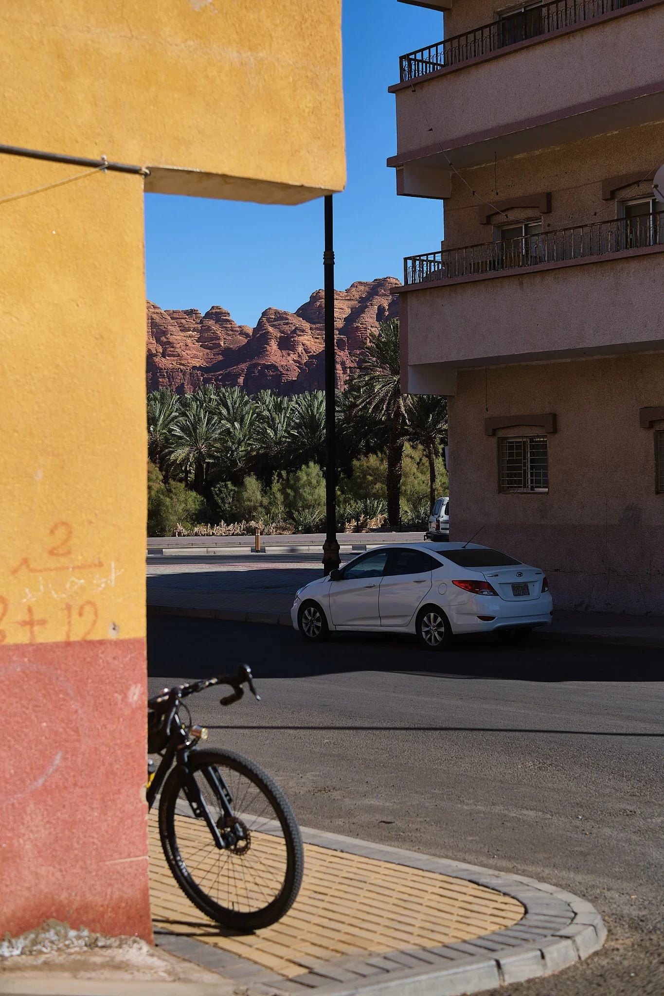
Following the bike path back to town is arguably the best option, and there will be a handful of masajid (mosques) along the way to fill up on water. The route takes you on paved back roads that eventually lead to the Heart of the Oasis parking lot. From there, things get a bit sandy in some sections, rideable still.
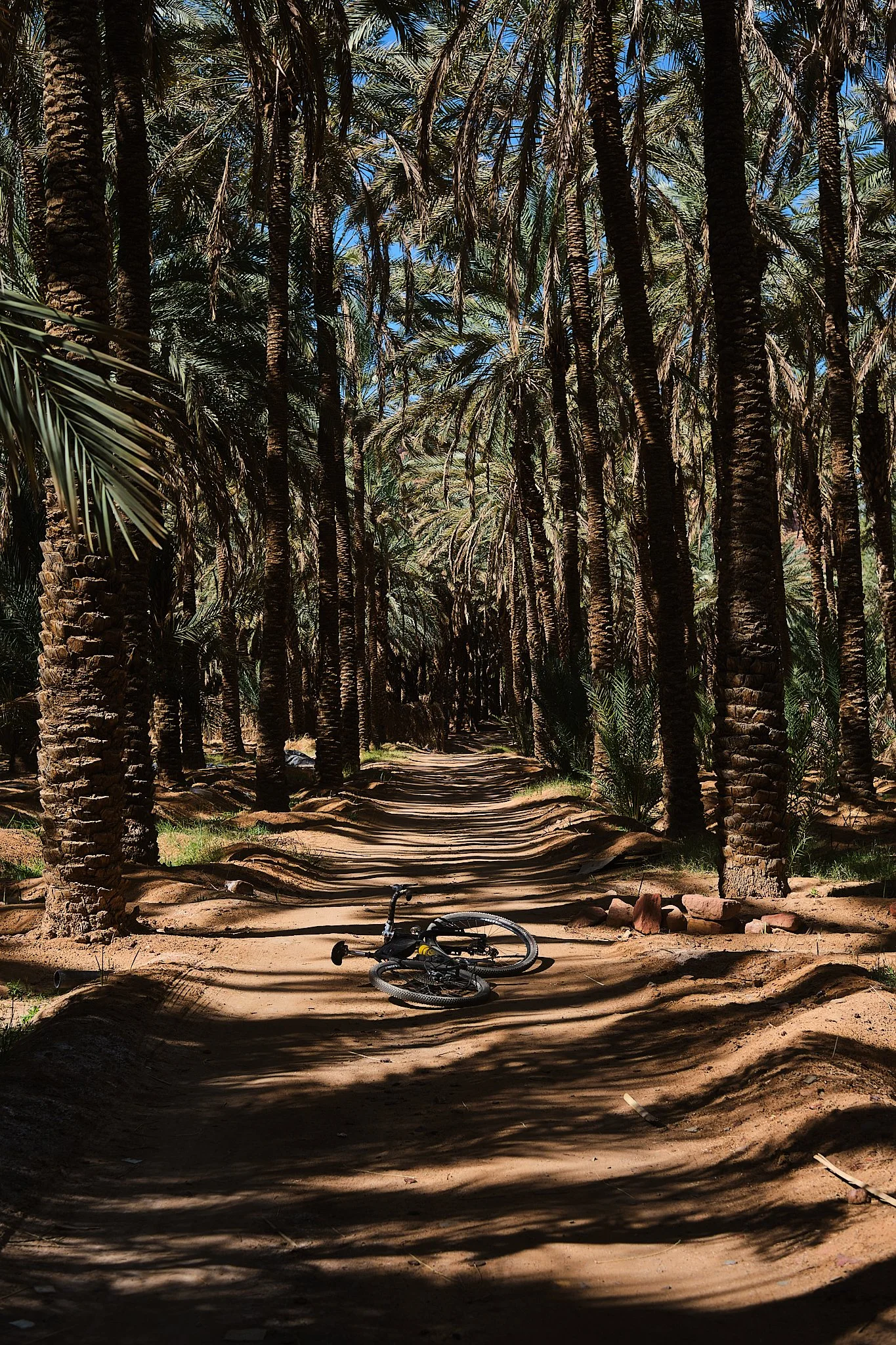
The last miles through the oasis are rich in history, views, and some of the best coffee spots the area has to offer, so I wouldn’t rush through it if I were you, after all when was the last time you ride under the shade of thousands of palm trees?
A note:
AlUla is rapidly growing, and I mean it in the literal sense of RAPIDLY growing. So things can be a bit different from this report when you ride the route, especially the first/last few miles near the oasis, so proceed with caution in terms of what's allowed to be ridden and what's not.
Extra Credit:
For the adventurous, I have a challenge for ya if you’re looking for one. Below is a route that shares the majority of the main route’s mileage; however, it adds an even harder climb and more gravel to your travel. The catch? I haven't ridden the north part, but you might!
Would love to hear about this version if you decide to ride it!